Gradual Warming Trend Ahead; Some Rain Late In The Weekend
ANOTHER COLD START: Here are some temperatures across Alabama this morning just before daybreak…
Ashville 10
Tuckers Chapel 13
Margaret 14
Gadsden 15
Cullman 16
Demopolis 16
Jasper 16
Florala 16
Morris 17
Meridianville 17
Decatur 18
Huntsville 18
Greenville 18
Prattville 18
Andalusia 18
Good Hope 18
Troy 19
Montgomery 20
Muscle Shoals 20
Anniston 20
Evergreen 21
Tuscaloosa 21
Haleyville 21
Birmingham 22
Gulf Shores 23
Mobile 24
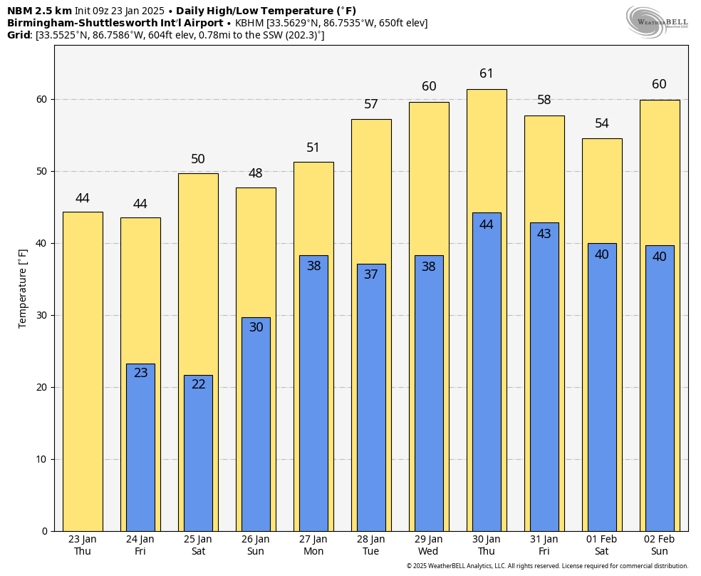
Today will be a mostly sunny day with a high in the 40s. Dry weather continues tomorrow and Saturday with highs in the 45-52 degree range; morning lows will stay in the 20s. Some colder spots will see teens early Saturday morning.
Clouds will return Sunday, and we will mention the chance of a few rain showers late Sunday, Sunday night, and Monday. Rain amounts will be light; highs Sunday and Monday will be in the upper 40s and low 50s.
REST OF NEXT WEEK: Global models are struggling with details, but it looks like a stalled surface front will be nearby with some risk of rain at times through the week. The week will be warmer with highs on most days in the upper 50s and low 60s. A widespread rain event is likely by Saturday (February 1)… See the video briefing for maps, graphics, and more details.
ON THIS DATE IN 1969: An F4 tornado cut a 120-mile long path from Jefferson through Copiah, Simpson, Smith, Scott, and Newton Counties in Mississippi, killing 32 and injuring 241 others.
ON THIS DATE IN 2012: Eleven tornadoes touched down during the early morning hours. An EF-2 moved through Oak Grove, in western Jefferson County, at 3:15 a.m. killing one person. Then, about one hour later, and EF-3 moved through Center Point and Clay, killing a Shades Valley High School student. This tornado was on the ground for 16 miles; 231 homes and businesses were damaged or destroyed.
Look for the next video briefing here this afternoon… enjoy the day!
Category: Alabama's Weather, ALL POSTS, Weather Xtreme Videos
About the Author (Author Profile)
James Spann is one of the most recognized and trusted television meteorologists in the industry. He holds the AMS CCM designation and television seals from the AMS and NWA. He is a past winner of the Broadcast Meteorologist of the Year from both professional organizations.Subscribe
If you enjoyed this article, subscribe to receive more just like it.


