Midday Nowcast: Sunny This Week, Rain Returns This Weekend, Another Arctic Blast Next Week
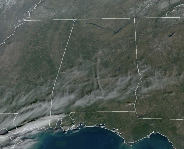
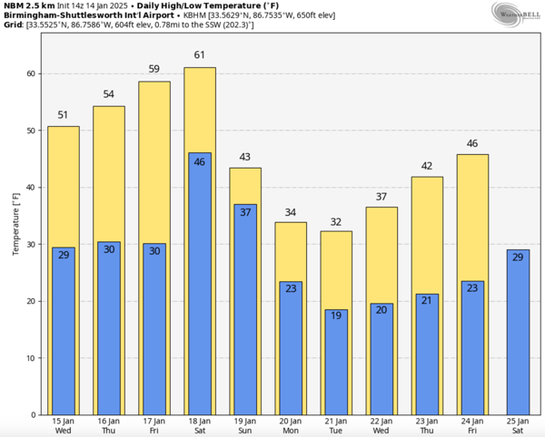
COOL DAYS, COLD NIGHTS: The weather is sunny and dry, but temperatures remain below average the next couple of days. Highs today and tomorrow will be in the upper 40s and lower 50s, while lows will be in the 20s. Thursday and Friday will remain dry, and we will begin a slight warming trend; highs will be in the mid to upper 50s over North/Central Alabama, with potential for low 60s across South Alabama. Clouds will increase Friday ahead of our next storm system.
BIRMINGHAM ALMANAC: For January 14th, the average high for Birmingham is 54° and the average low is 35°. The record high is 78° set in 1932, while the record low is 13° set in 1963. We average 0.16” of precipitation on this date and the record value is 1.20” set in 2013.
ACROSS THE USA: Critical to extremely critical fire weather conditions will continue for southern California through Wednesday due to moderate to locally strong Santa Ana winds. Red Flag Warnings are in effect. A fresh Arctic blast will impact the eastern half of the U.S. through the middle of this week before milder temperatures briefly return by week’s end. Heavy lake effect snow is expected in the Great Lakes.
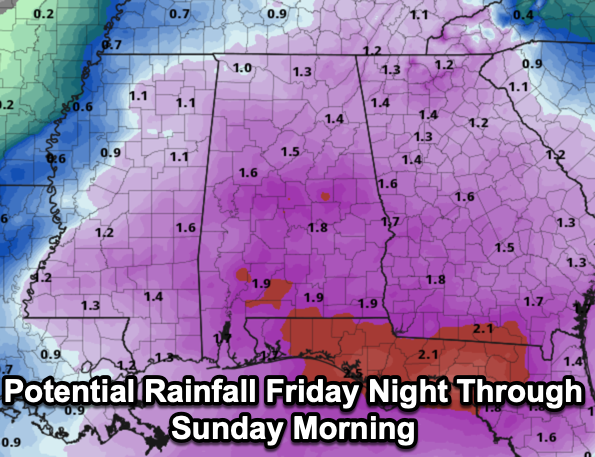
THE ALABAMA WEEKEND: Rain becomes widespread across Alabama Friday night into Saturday; amounts of 1 to 2 inches are likely statewide. Some thunder is possible, but severe storms are not expected. Temperatures will be in the 50s and 60s, so there is also no threat of frozen precipitation. The rain ends early Sunday, and much colder air will roll into the state during the day, in fact, Sunday will feature falling temperatures all days and with a brisk north wind, it will be feeling much colder. There is likely going to be a few snow flurries flying around Sunday as the moisture departs.
BACK INTO THE DEEP FREEZE: The coldest air so far this winter moves into the Deep South next week, with highs in the 20s and 30s and lows in the teens for the northern half of the state for the at least the first half of the week. With cold air remaining in place, all we need is some moisture, and we could have another round winter weather mischief for Alabama. The American, GFS model continues to hint at some risk of wintry precipitation across Alabama Tuesday or Tuesday, but the reliable European model shows a weaker system, much farther to the south in the Gulf, and just keep it cold and dry here. Way too early to know what or if anything will happen, just know we are watching future model runs, but for now, we are going to keep the forecast dry, but this forecast could and will likely change in the coming days. Temperatures will likely remain below average through the rest of January.
WORLD TEMPERATURE EXTREMES: Over the last 24 hours, the highest observation outside the U.S. was 115.3F at Windorah Airport, Australia. The lowest observation was -59.4F at Suhana, Russia.
CONTIGUOUS TEMPERATURE EXTREMES: Over the last 24 hours, the highest observation was 86F at Ochopee, FL. The lowest observation was -27F at Northgate, ND.
Category: Alabama's Weather, ALL POSTS, Social Media


