Midday Nowcast: Clearing Sky With Colder Air Arriving Tonight
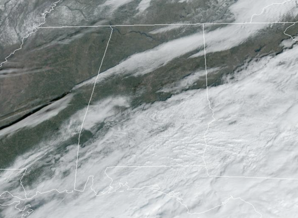
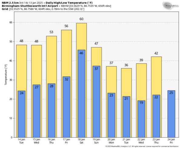
We are seeing a clearing sky this afternoon and temperatures are in the upper 40s and lower 50s. Tonight, colder air arrives in Alabama, expect lows in the low to mid 20s tomorrow morning. The weather will be sunny and dry, but stays cold tomorrow and Wednesday with highs in the 40s and lows in the 20s. The temperatures remain nearly ten degrees below average for this time of year.
BIRMINGHAM ALMANAC: For January 13th, the average high for Birmingham is 54° and the average low is 35°. The record high is 78° set in 2017, while the record low is 5° set in 1918. We average 0.16” of precipitation on this date and the record value is 1.93” set in 2013.
ACROSS THE USA: Critical to extremely critical fire weather conditions are forecast for coastal southern California through Wednesday due to moderate to locally strong Santa Ana winds. Particularly Dangerous Situation Red Flag Warnings have been issued. Across the Great Lakes, heavy lake effect snow is expected downwind of Lakes Erie and Ontario from this afternoon into late Wednesday night.
SLIGHTLY WARMER: Thursday and Friday will remain dry, and we will begin a bit of a warming trend; highs will be in the 50s over North/Central Alabama, with potential for low 60s near the coast. Clouds will increase Friday ahead of our next storm system.
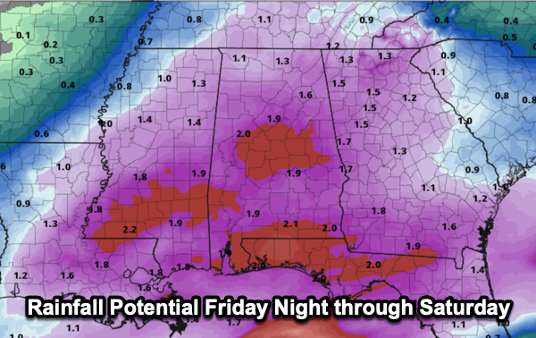
THE ALABAMA WEEKEND: Rain becomes widespread across Alabama Friday night into Saturday; amounts of 1 to 2 inches are likely statewide. Some thunder is possible, but severe storms are not expected. Temperatures will be in the 40s and 50s, so there is also no threat of frozen precipitation. The rain ends early Sunday, and much colder air will roll into the state during the day, in fact, Sunday will feature falling temperatures all days and with a brisk north wind, it will be feeling much colder.
VERY COLD NEXT WEEK: We have potentially the coldest air so far this season settling into the Deep South next week, with highs in the 30s and lows in the teens for the northern half of the state for the at least the first half of the week. With cold air remaining in place, all we need is some moisture, and we could have another round winter weather mischief for Alabama. For now, the reliable European global model has shown a signal for a potential snow threat for parts of the state at some point, but consistency has not been good it is simply too early to know if we will deal with any snow or ice this time. Temperatures will likely remain below average through the rest of January.
WORLD TEMPERATURE EXTREMES: Over the last 24 hours, the highest observation outside the U.S. was 113.4F at Urandangi Aerodrome, Australia. The lowest observation was -60.7F at Delyankir, Russia.
CONTIGUOUS TEMPERATURE EXTREMES: Over the last 24 hours, the highest observation was 78F at Homestead, FL. The lowest observation was -22F at Badoura, MN.
Category: Alabama's Weather, ALL POSTS, Social Media


