Sunday Morning Snow Cover and Chilly Temps; Rain Tonight Mainly South
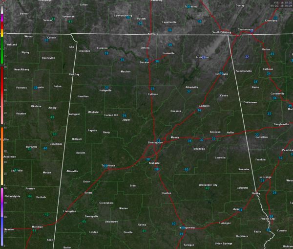
Those aren’t clouds you see on the visible satellite imagery over North and North Central Alabama, that’s snow cover!
Temperatures are mainly in the 30s right now over the northern half of Alabama, with 40s start to show up over southern sections.
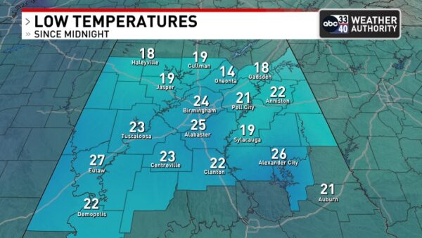
Low this morning looked like this:
The beautiful snow from our little Friday Snow Day will be gone later today with bright sunshine and readings in the mid and upper 40s.
Our next disturbance is already spreading showers across eastern Texas and southern Louisiana where there are lots of clouds this morning. This system will come eastward spreading rain into Southwest Alabama this evening and across mainly the southern half of the state overnight.
The HRRR is a little more aggressive with the northern extent of the precipitation shield with some precip reaching the US-80 Corridor around 10-11 pm and Tuscaloosa-Birmingham around 2-3 a.m. Temperatures should be in the lower 40s southwest and colder upper and middle 30s to the northeast. I don’t think any of that precip will be able to start as sleep because of atmospheric temperature profiles, but stranger things have happened. So if you wake up to a little snap, crackle and pop around 2-4 a.m., especially further east, don’t be surprised!
Category: Alabama's Weather, ALL POSTS, Social Media


