Saturday Briefing — Remaining Cold Through the Weekend; Rain for Some on Monday
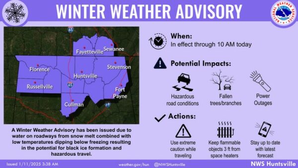
After a frigid and snow-covered day for the northern half of the state, and cold and dreary conditions in the south, we return to a dry pattern today in Alabama. We may still have some icy conditions on roadways, and for that reason, NWS Huntsville has their North Alabama counties in a Winter Weather Advisory until 10AM this morning.
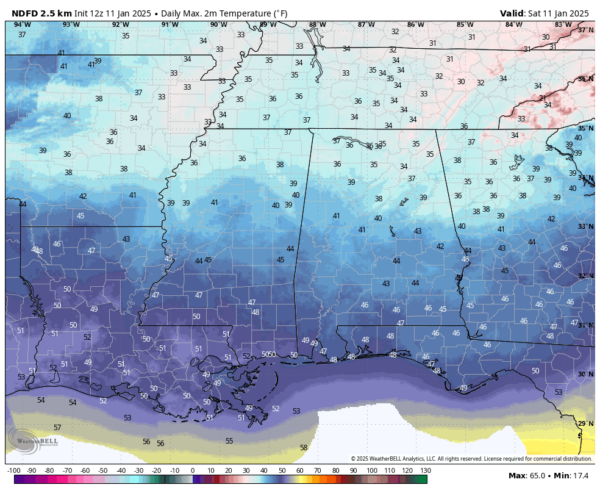
The good news is that we will see afternoon highs above freezing, reaching the mid 30s to the upper 40s across the state. Unfortunately, it may take a while for the sun to break through the clouds and lend some solar help in melting ice, as those clouds will be very slow in moving out. Any water on roadways tonight will likely freeze once again as lows dip down in the mid-teens to the upper 20s.
On Sunday, after waking up in the freezer, we’ll see a good amount of sunshine with a few clouds. The good news is that those afternoon highs will be warmer, reaching the lower 40s to the upper 50s.
A disturbance will be moving through the southeast on Monday, that will bring showers to the southern half of the state. While temperatures will remain below normal, highs will be in the lower 40s to the lower 50s.
High pressure dominates our weather on Tuesday, which will allow for plenty of sunshine and colder temperatures with highs in the mid 30s to the mid 50s across the state from north to south. Overnight lows will be in the mid-teens to the lower 30s.
We’ll remain colder on Wednesday as that high pressure remains in place. Skies will be sunny with highs in the mid 30s to the mid 50s.
The highs moves off eastward, and we start to see our flow come more out of the west and southwest on Thursday. That will allow for slightly warmer air to move in, as highs reach the lower 40s to the mid 50s.
The flow becomes southerly on Friday as our next rainmaker organizes off to our west. Temperatures will be warmer, and we’ll start to see some clouds move in through the day. Highs in the upper 40s to the lower 60s from northeast to southwest. Showers will begin to move into the southwestern parts of the area during the evening hours and exiting by midday Saturday.
Category: Alabama's Weather, ALL POSTS, Social Media, Weather Xtreme Videos, Winter Weather


