Mixed Winter Precipitation is Occurring in Mississippi; Here’s What to Expect Overnight in Alabama
Temperatures are beginning to drop across the state, and they will continue to plummet overnight. By midnight, areas north of Birmingham will be just around or below 32 degrees. Around this time, precipitation will move into North Alabama from the west. We will likely see snow in many northern Alabama cities, with the chance of snow decreasing towards the south. Later, around 3am, Tuscaloosa and Birmingham will see temperatures right around 32 degrees. This brings some uncertainty regarding the type of precipitation – snow, sleet, or freezing rain will be possible.
The northern third of the state could see around 2 to 3 inches of snow accumulation. In the mid-state, chances for snow accumulation are slim. There is a chance of 0.5 to 1 inches of snowfall in Tuscaloosa and Birmingham; however, the main concern in these areas will be ice. In South Alabama, there will only be rain.
If you are travelling tomorrow, especially in the northern half of the state, remain vigilant on the roads. Ice patches can be hard to spot, and oftentimes drivers notice ice once it is too late. Please refer to local officials regarding road conditions in your area.
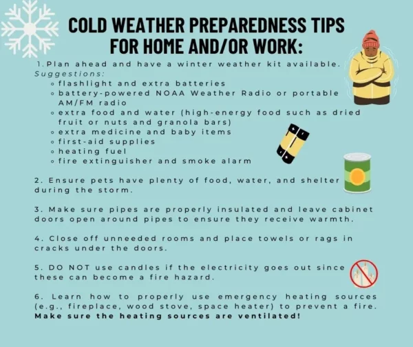
While widespread power outages due to ice accumulation are unlikely, it is important to be prepared. If you are in an area where snow or freezing rain is expected, you may want to take a few actions steps tonight before you go to bed. Please refer to the following graphic for specifics:
Category: Alabama's Weather, ALL POSTS, Social Media


