Winter Storm Potential For North Alabama Friday
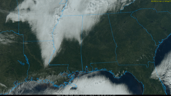
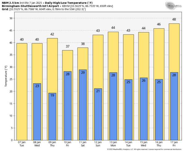
COLD AIR IN PLACE: For most of Alabama, the sky is sunny this afternoon… but the exception is the northwest part of the state where clouds are hanging tough at mid-afternoon. Temperatures under the cloud cover are hovering around freezing… elsewhere we have upper 30s and low 40s. Tonight will be mostly fair and cold with lows in the 20s; some of the colder spots will see upper teens.
The weather will stay cold and dry Thursday.
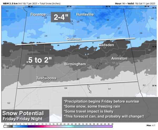
WINTER STORM POTENTIAL FRIDAY: A surface low is forecast to form along the Louisiana coast Thursday night, and that will spread wintry precipitation into the northern half of Alabama after midnight Thursday night into Friday. Here are the key messages…
*Hazardous/icy travel is likely Friday morning along and north of I-20 (Tuscaloosa to Birmingham to Anniston), and possible as far south as a line from Moundville to Clanton to Roanoke. Some bridge icing is even possible (but not especially likely) as far south as I-85 (Montgomery to Opelika).
*New model data suggests snow could linger through the midday and afternoon hours north of I-20, with a cold rain over the southern half of Alabama.
*Highest snow amounts will be over the northern third of Alabama; our forecast is for 2-4 inch potential along and north of U.S. 278 (Hamilton to Cullman to Gadsden). Snow accumulation of 1/2 to 2 inches are possible down to places like Tuscaloosa, Birmingham, Anniston, and Gadsden, but some of the wintry precipitation there could fall in the form of freezing rain.
*Understand the forecast snow totals could (and probably will) change as new model data comes in and we get better clarity. The ground and infrastructure will be cold, air coming in from the north is moving over an impressive snow pack, and we could have some evaporative cooling at the onset of the precipitation early Friday morning. These factors are favorable for an impactful winter storm event over North Alabama.
*Travel issues will likely continue over North Alabama into Saturday morning, even though the main precipitation/snow event will end Friday night. Roads over North Alabama will most likely show some improvement by Saturday afternoon with temperatures inching above freezing.
*A winter storm watch will likely be issued for much of North Alabama at some point tonight or tomorrow morning.
*A few lingering show flurries or snow showers are possible in the cold air Saturday on the back side of the departing storm system.
*Remember this forecast can, and probably will change as we get closer to Friday. Like tropical forecasts, when you are working with old information you are working with bad information, so be sure and watch for updates.
Our weather will be cold and dry Sunday through most of next week with highs in the 40s and lows in the 20s. See the video briefing for maps, graphics, and more details.
ON THIS DATE IN 1989: Empty foundations are all that remain of four homes on the southwest end of Allendale, Illinois after an F4 tornado ripped through. The tornado was extremely rare due to its strength and the fact that it occurred so far north during the middle of meteorological winter.
Look for the next video briefing here by 6:00 a.m. tomorrow…
Category: Alabama's Weather, ALL POSTS, Weather Xtreme Videos


