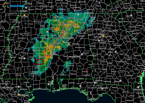
A Brief Update Just Before 10PM
As of 9:50pm, we currently have no active warnings for Alabama, but the line of rain and storms continues to move eastward through the area, stretching from north of Scottsboro to Jasper to south of York. Gusty winds can be expected, and we still cannot rule out a brief spin up tornado along and west of I-65.
There is a tornado warning in effect for portions of Jasper and Clarke counties in southeastern Mississippi. That cell will eventually move into the southwestern parts of Sumter County within the next 30–45 minutes. No other severe warnings are in effect for anywhere along the line.
Wind shear is the highest over the west and southwestern parts of the state, along with helicity values capable of rotating updrafts. However, surface-based instability is very low. However, it doesn’t take much instability to get one of these quick spin up tornadoes to quickly drop and lift back up. The good news is that much of Alabama has a near zero values in the Significant Tornado Parameter, with only Southwest Alabama reaching 0.5.
Category: Alabama's Weather, ALL POSTS, Severe Weather, Social Media


