Brief Severe Weather Update at 8:30PM
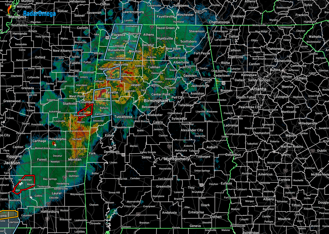
We have some active storms out there over the western parts of the state, including a potential tornado touchdown near Vina in Franklin County, with power outages reported. A couple of more cells have shown some brief rotation, but as for now, no reports of damage or tornadoes being sighted.
While no warnings are currently in place for Alabama, the severe threat will continue for several more hours for the western 2/3rds of the state. The latest update on the threat window for severe weather is as follows…
– Now through 11PM – Locations west of a line from Huntsville to Jasper to Demopolis.
– 10PM to 1AM – East of the above-mentioned line to as far east as just east of Huntsville to Alexander City to Brewton.
– No Severe Threat – For locations in east Alabama.
These brief spin ups are very hard to detect and warn for, as they will appear on one radar scan, and be gone by the next scan. Stay weather aware and treat severe thunderstorm warnings just like tornado warnings as those brief spin ups are possible.
Category: Alabama's Weather, ALL POSTS, Severe Weather, Social Media
About the Author (Author Profile)
Scott Martin is an operational meteorologist, professional graphic artist, musician, husband, and father. Not only is Scott a member of the National Weather Association, but he is also the Central Alabama Chapter of the NWA president. Scott is also the co-founder of Racecast Weather, which provides forecasts for many racing series across the USA. He also supplies forecasts for the BassMaster Elite Series events including the BassMaster Classic.Subscribe
If you enjoyed this article, subscribe to receive more just like it.


