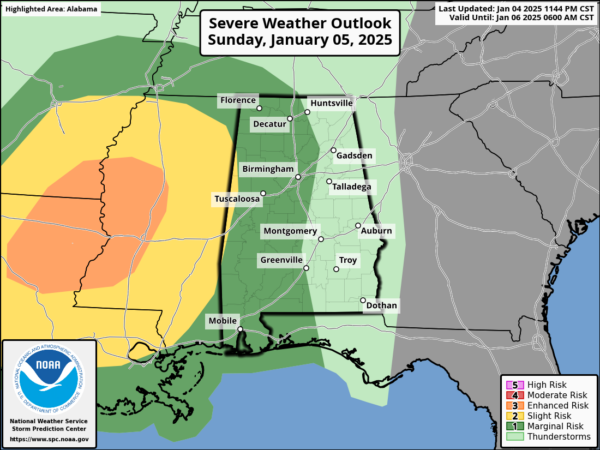
New Day One Is Out: Small Threat of Severe Weather Overnight Sunday Night
For Alabama:
The organized line of strong to severe thunderstorms (QLCS) will approach western Alabama during the evening hours Sunday night, but the risk for severe weather will be notably lower across the state due to a more stable air mass and limited boundary-layer instability. While damaging wind gusts and an isolated tornado cannot be ruled out west of I-65, the overall severe threat will decrease as the storms move eastward. Most areas will see rain and gusty winds, but the severe potential should diminish quickly overnight.
To our west:
The greatest severe weather threat will be from eastern Texas into Louisiana, Mississippi, and southern Arkansas, where an enhanced risk has been issued. In these areas, strong boundary-layer destabilization will support the development of a broken squall line or QLCS, with embedded supercells capable of producing severe wind gusts, tornadoes, and isolated large hail. The highest tornado potential will be across Louisiana and western Mississippi, where strong low-level wind shear and adequate instability will exist during the afternoon and evening.
Category: Alabama's Weather, ALL POSTS, Severe Weather, Social Media


