Midday Nowcast: Sunny Days Before Big Changes in the Weather this Weekend
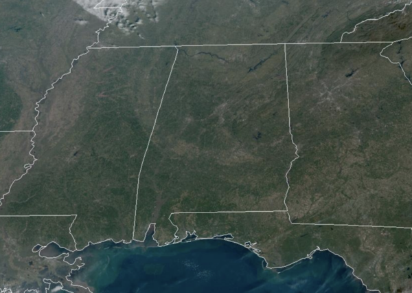
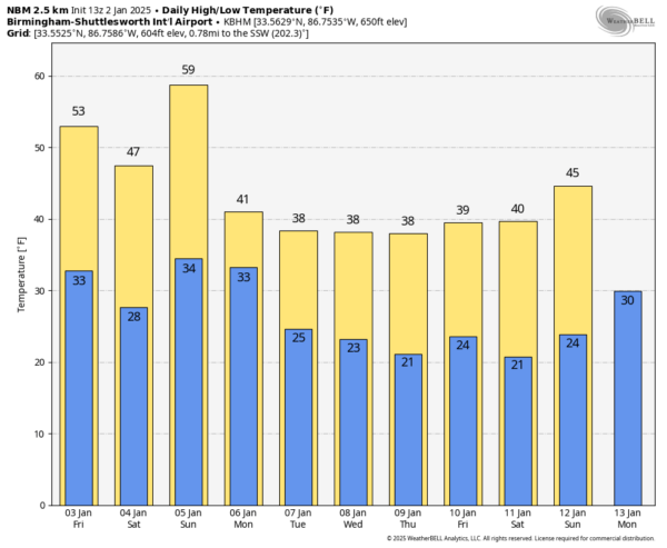
SUNNY, CALM WEATHER: For today and tomorrow, we continue to see dry and sunny weather. Temperatures are right where they should be this time of year with highs in the low to mid 50s, while overnight lows are in the lower 30s.
BIRMINGHAM ALMANAC: For January 2nd, the average high for Birmingham is 54° and the average low is 36°. The record high is 77° set in 2006, while the record low is 5° set in 1928. We average 0.16” of precipitation on this date and the record value is 3.26” set in 1937.
ACROSS THE USA: In the wake of a storm lifting through the Canadian Maritimes, heavy snow will continue downwind of the Great Lakes through this weekend and over parts of the Appalachians and interior Northeast through Friday along with gusty winds. Several Pacific storms will continue periods of low elevation rain showers and mountain snow over the Northwest U.S. today thorough this weekend.
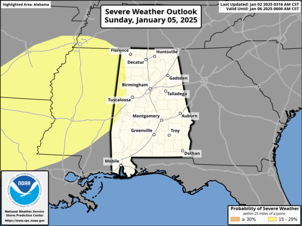
THE ALABAMA WEEKEND: Saturday will be colder with a high in the upper 40s in the wake of an “Alberta Clipper” system which will move through the state Friday night. Then for Sunday and Sunday night, a dynamic storm system will bring rain and storms back to Alabama. The Storms Prediction Center (SPC) has defined a risk of severe thunderstorms for the extreme western part of Alabama, and westward across much of Mississippi.
However, for most of Alabama, surface based instability will be low, and the overall threat of severe storms here remains very low. Rain amounts will be around one inch for the northern half of the state, with amounts closer to 1/2 inch for South Alabama. Additionally, gradient winds (not related to thunderstorms) will ramp up late in the weekend, possibly gusting to 30/40 mph at times, and these can cause tree and power issues on their own. We are likely going to see a Wind Advisory issued for these winds on Sunday.
OPENING OF THE ARCTIC FLOODGATES: The rain will end early Monday, and then a strong, icy northerly wind will bring very cold air into Alabama as highs will hold in the 30s. Even a few snow flurries are possible as the moisture departs on Monday. Tuesday and Wednesday will be sunny and cold across not just Alabama, but the eastern half of the U.S.
Then for the second half of the week, model madness continues…The American GFS continues to hint at a surface low in the northern Gulf of Mexico with potential for a winter storm over parts of Alabama, while the European and Canadian global models show basically nothing. Still too early to know if we have any snow or ice, but expect much better clarity by the weekend.
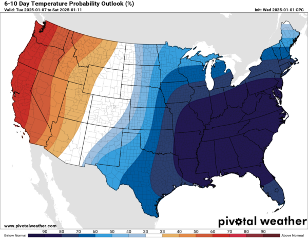
Everything you see shaded in blue is where the Climate Prediction Center is forecasting temperatures well-below average over the 6-10 day forecast period. The darker the shade of blue, the higher the confidence in below average temperatures and this matches model output data, which is NOT a forecast, but just trends we look at to get a general idea of what COULD happen.
We are going to remain the Deep Freeze for a couple of weeks as lows in the teens are possible over North Alabama. We are all need to be prepared to deal with a very cold couple of weeks stretch across Alabama. Typically, the mid to late part of January is the coldest period of the year climatologically for Alabama and this year looks to verify that data.
WORLD TEMPERATURE EXTREMES: Over the last 24 hours, the highest observation outside the U.S. was 111.2F at Augrabies Falls, South Africa. The lowest observation was -68.1F at Agayakan, Russia.
CONTIGUOUS TEMPERATURE EXTREMES: Over the last 24 hours, the highest observation was 84F at Ochopee, FL. The lowest observation was -13F at Opheim, MT.
Category: Alabama's Weather, ALL POSTS, Social Media


