Severe Weather Risk Continues Across Central AL; New Mesoscale Discussion Issued
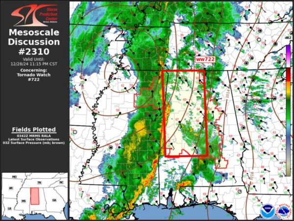
The risk of severe weather will continue to ramp up over central Alabama tonight as the line of severe storms continues to track eastward. These storms have a history of producing tornadoes and widespread damaging winds with some gusts up to 70mph. The SPC is continuing to monitor the threat, and has highlighted central and northern AL in a new mesoscale discussion.
Reminder: A tornado watch remains in effect until 4am for much of the region. Stay very weather aware tonight and ensure you have multiple ways to receive warnings.
Category: Alabama's Weather, ALL POSTS, Social Media


