Radar Check: Severe Squall Line Taking Shape to Our West
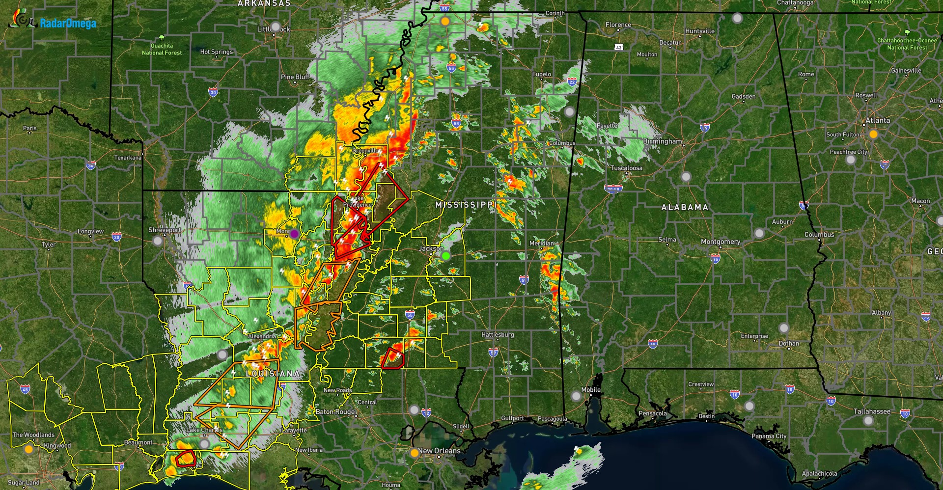
As of the top of the hour, a line of severe storms was moving east into western Mississippi, with discrete cells out ahead of it. While the entire line has both tornado warnings and severe thunderstorm warnings, the discrete cells have actually produced at least one very large tornado with severe damage to buildings in its path.
This line of storms will continue to move eastward, and will likely enter west Alabama around 10-11pm tonight, however isolated supercells may develop as early as 7pm. Any storm will be capable of producing damaging winds (some gusts near hurricane force), large hail, and several tornadoes especially west of I-65. An isolated strong, EF2 or higher, tornado cannot be ruled out as well. With this timing in mind, a tornado watch will likely be issued within the next 1-2 hours, and will likely cover much of central Alabama.
Please continue to stay weather aware this evening and especially overnight.
Category: Alabama's Weather, ALL POSTS, Social Media
About the Author (Author Profile)
Jack is a junior at Mississippi State University studying meteorology. He has several years of forecasting experience through a local group of forecasters in Maryland where he resides. Jack plans to become a broadcast meteorologist after graduation.Subscribe
If you enjoyed this article, subscribe to receive more just like it.


