SPC Monitoring The Severe Weather Risk Over Western Alabama
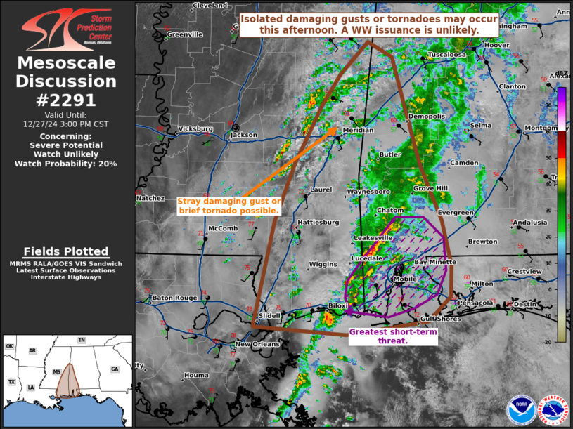
The Storm Prediction Center continues to monitor a low end risk of severe weather today across western Alabama, and has recently issued a mesoscale discussion regarding this threat. Widespread showers and thunderstorms are ongoing, which is keeping the airmass stable. And for this reason, the risk for severe weather is low, and a watch issuance is not anticipated at this time. The strongest storms could produce gusty winds or a brief tornado mainly over SW Alabama.
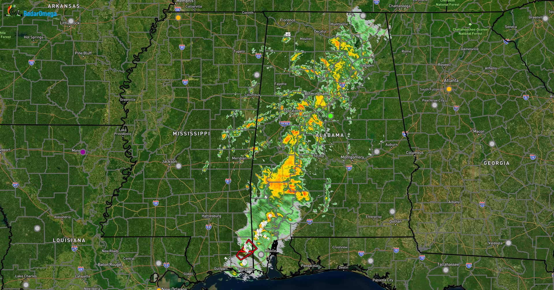
Current radar depicts the showers and storms well, with a tornado warning in effect for extreme SW Alabama well outside of our coverage area. This storm does have a history of producing a tornado so those in the polygon should seek immediate shelter.
Category: Alabama's Weather, ALL POSTS, Social Media
About the Author (Author Profile)
Jack is a junior at Mississippi State University studying meteorology. He has several years of forecasting experience through a local group of forecasters in Maryland where he resides. Jack plans to become a broadcast meteorologist after graduation.Subscribe
If you enjoyed this article, subscribe to receive more just like it.


