Alabama Update: Strong Wedge Keeping Things Cool, Holding Down Today’s Threat for Strong Storms; Some Timing for Tomorrow’s Severe Weather Threat
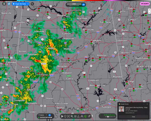
Today, a weak front is moving into the area bringing mostly rain showers to Alabama. The nearest lightning strikes this hour are over Wayne and Greene counties in Mississippi. Some thunder may move into the Choctaw and Washington County areas over the next hour, but there is just not much in the way of storms.
The SPC does have a marginal risk (level 1 out of 5) posted for areas from Tuscaloosa southward today, but the risk is very minimal and probably limited to Sumter, Marengo, Greene, Hale, and Perry counties southward. The primary concern isa stray storm capable of strong winds or small hail, mainly between noon and 8 PM. A strong surface wedge and limited instability should keep activity subdued, although we can’t entirely rule out a quasi-organized storm in the southwest. Temperatures will run cooler today due to persistent cloud cover and easterly winds. I am going to lower temperature expectations.
Here is the current radar:
The showers will shift eastward over the next couple of hours. They should be moving through the Birmingham area between 12:30-2 p.m. No lightning is expected.
Then a line of stronger showers will form around 3-4 p.m. over western Alabama and sweep eastward through the evening hours. More moderate showers could impact the Birmingham area between 5-630 p.m.
For the Birmingham Bowl, this means rain could impact Protective Stadium during the pregame and tailgate periods. Gates open at 1 p.m. which is when the next round of showers will be moving through. There should only be light showers during the game until the stronger line of showers arrives in the third or fourth quarter. And it could be wet as you head ot dinner after the game.
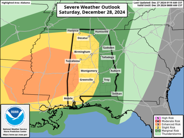
The focus shifts to Saturday, where a more significant severe weather system is expected. An enhanced risk is in place for portions of west and central Alabama, with the potential for damaging winds, large hail, and isolated tornadoes. Timing for the first wave of storms begins in the afternoon, primarily west of I-65, with hail and straight-line winds the primary concerns.
Later in the evening, the low-level jet strengthens, increasing the risk of tornadoes, especially in western areas, as a cold front pushes through overnight.
TIMING DETAILS:
– West Alabama (Hamilton, Jasper, Tuscaloosa, Demopolis): 3 PM Saturday – 2 AM Sunday.
– I-65 Corridor (Huntsville, Cullman, Birmingham, Clanton, Montgomery, Greenville): 4 PM Saturday – 5 AM Sunday.
– East Alabama (Anniston, Gadsden, Auburn, Troy): 4 pm Saturday – 8 am Sunday.
By noon Sunday, the front should clear the region, ending the severe threat. Stay weather-aware, especially if you live in western areas, and ensure you have multiple ways to receive warnings. We will have frequent updates throughout the event.
Category: Alabama's Weather, ALL POSTS, Severe Weather, Social Media


