Afternoon Briefing Video: Forecast Comes Into Clearer Focus
MILD WEATHER CONTINUES AS CHRISTMAS APPROACHES
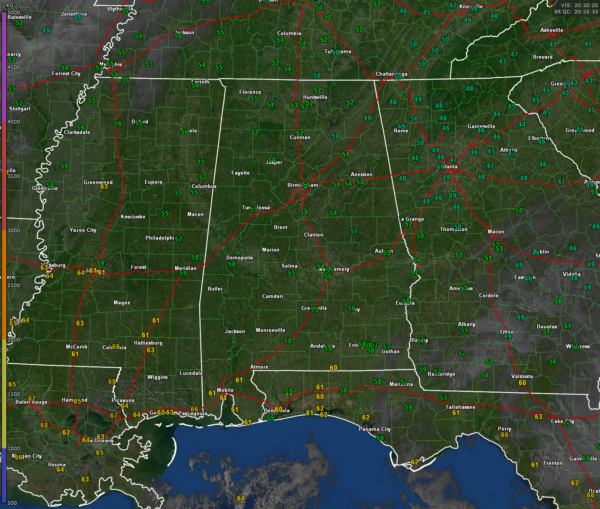
The start of the holiday week brings sunny skies and slightly warmer conditions across Central and North Alabama. High pressure remains firmly in control, with highs this afternoon reaching the mid-50s under abundant sunshine. Southeast winds at 6-10 mph will help moderate temperatures, signaling a gradual warming trend. Tonight, clear skies and calm winds will allow for excellent radiational cooling, with lows dipping into the upper 20s in some areas and low 30s elsewhere.
CHRISTMAS EVE: SUNNY AND SEASONABLE
Tuesday, Christmas Eve, will feature mostly sunny skies and milder temperatures as a ridge temporarily builds over the region. Morning lows will start in the low 30s, but highs will climb to near 60 degrees by afternoon. A few high clouds may move into northwest Alabama late in the day, but any rain chances will hold off until much later. Southeast winds will remain light at 3-6 mph, making for comfortable holiday preparations and travel conditions.
SHOWERS LIKELY ON CHRISTMAS
Christmas Day starts off partly cloudy in the morning, but skies will become increasingly overcast during the afternoon as moisture streams in ahead of a weak shortwave trough. While the day itself will remain mostly dry, scattered showers are likely to develop by the evening hours, particularly across southern and western parts of the area. Rainfall amounts will be light, around 0.20 inches, with no severe weather expected. Highs will be in the low 60s, with light easterly winds providing a mild and pleasant feel for much of the day.
THURSDAY: LINGERING CLOUDS AND SHOWERS
Some light rain or drizzle may linger into early Thursday morning as moisture remains trapped under a stable airmass. Skies will gradually clear throughout the day, though cloud cover may persist longer in some areas. Highs will reach around 60 degrees once again, with winds picking up slightly from the east-southeast at 6-11 mph. Rainfall will be minimal, generally less than 0.05 inches, but the overcast conditions may make for a gray start to the day.
FRIDAY BRINGS MORE CLOUDS AND RAIN
Friday will feature increasing rain chances as another shortwave moves through the region. The morning starts off cloudy, with light showers developing during the afternoon and becoming more widespread Friday night. Highs will reach the low 60s, but southeast winds at 10-15 mph will make it feel a bit cooler. Rainfall amounts will remain modest, around 0.25 inches, with no significant weather hazards expected.
ACTIVE WEEKEND AHEAD
Saturday brings an uptick in activity as a stronger system approaches. Showers and thunderstorms are expected to develop during the day, with heavier rain and embedded storms likely Saturday night. Rainfall totals could exceed 1 inch in some areas, with locally higher amounts possible. Winds will become breezy, shifting from the southeast to the south-southwest at 12-18 mph. While the overall severe weather threat remains low, a marginal risk for isolated strong storms will be monitored closely.
SUNDAY: SHOWERS TAPER OFF
Rain will taper off Sunday morning, leaving behind partly cloudy skies for the afternoon. Temperatures will remain mild, with highs in the low 60s. Winds will shift to the west at 5-10 mph, with occasional gusts up to 18 mph. While rain totals will generally be light on Sunday, localized flooding from the weekend’s heavier rainfall may linger in some low-lying areas.
OUTLOOK INTO NEXT WEEK
As we move into the final days of December, the weather pattern will remain active but mild. Monday looks to feature a mix of sunshine and clouds, with highs climbing into the mid-60s. Another frontal system may approach by midweek, keeping rain chances alive and temperatures above seasonal averages. Stay tuned for updates as we monitor the evolving pattern heading into the new year!
WEATHERBRAINS
The current WeatherBrains podcast is a home-grown special featuring our regular panelists. There’s something cozy about gathering around the wooden mahogany table for a lively and engaging discussion. As always, the conversation is spirited and insightful, and we’re thrilled to have you join us for this week’s brand-new episode of WeatherBrains! Get it wherever you get your podcasts.
TODAY IN WEATHER HISTORY
In the early hours of Sunday, December 23, 1956, just two days before Christmas, a family of four small tornadoes carved a remarkable 121.7-mile path across South Central Alabama. The tornadoes struck Monroe, Conecuh, Butler, Lowndes, Montgomery, Elmore, and Tallapoosa counties, beginning in Excel and skipping through Burnt Corn, Searcy, Fort Deposit, Pintlala, Snowdoun, and Mt. Meigs before lifting near Reeltown.
Significant damage was reported along the path. In Excel, two homes and an auto repair shop were destroyed, with two residents rescued from the rubble. Burnt Corn experienced extensive damage to several homes. In Fort Deposit, a house and the bleachers at the high school football stadium were heavily damaged. The most severe destruction occurred in Mt. Meigs, where four homes were completely destroyed, hundreds of trees were uprooted, and Christmas decorations from a home were found scattered among the wreckage. The Associated Press captured the poignancy of the event, noting, “Neatly wrapped Christmas presents were scattered for hundreds of feet, and a decorated Christmas tree was found among the wreckage at Mt. Meigs.” Rated as an F2 by Tom Grazulis in Significant Tornadoes, the Mt. Meigs tornado was the strongest of the day. This outbreak served as a somber reminder that tornadoes do not take holidays off in Alabama.
Category: Alabama's Weather, ALL POSTS, Social Media


