Saturday Briefing — Breezy with Showers Moving In Late
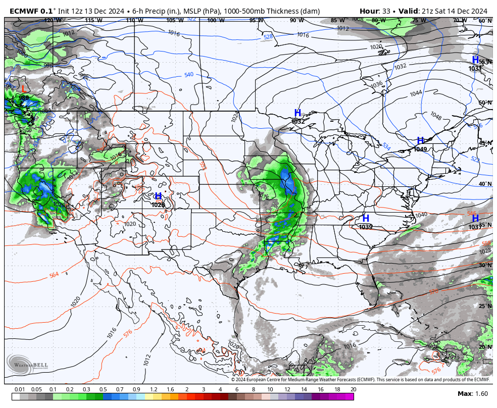
THIS WEEKEND: Much of today will be dry across Central Alabama with clouds moving in through the day. A cold front heading in our direction will bring some showers to the area as early as late afternoon in the extreme northwestern parts of the area, but nearly all the shower activity should hold off until after sunset. Highs in the mid 50s to the mid 60s.
On Sunday, the front will become more flat than diagonal, with much of the scattered shower activity being contained to the northern half of the state. I would say south of I-20, you should stay dry through the day. Highs in the lower 50s to the upper 60s.
THE FINAL FULL WORK WEEK OF 2024: Another front gets a push into the southeast on Monday, that will bring more showers to the area during the evening and overnight hours. A few claps of thunder may be heard over the western half of the state as there will be just enough instability for some thunderstorms. The good news is that severe weather is not on the board at the moment. Highs in the lower 60s to the lower 70s.
Showers and a few thunderstorms will continue to be possible over the northern half of the state on Tuesday as the front washes out and keeps an active pattern in place. I can’t rule out a strong storm or two, but this does not scream “severe weather threat.” Otherwise, skies will be partly sunny with highs in the upper 50s to the mid 70s.
A deepening trough will help push the front through the state on Wednesday, keeping showers and storms possible through the evening hours, then we start to dry out after the frontal passage. Rain should be out of the state before midnight. Highs in the upper 50s to the mid 70s.
The front heads out to the east and eventually out over the Atlantic Ocean on Thursday, and we’ll be dry with much cooler temperatures. Highs in the mid 40s to the upper 50s. Much of the same story on Friday as we’ll be dry with plenty of sunshine. However, temperatures will remain rather cool, only reaching the upper 40s to the upper 50s.
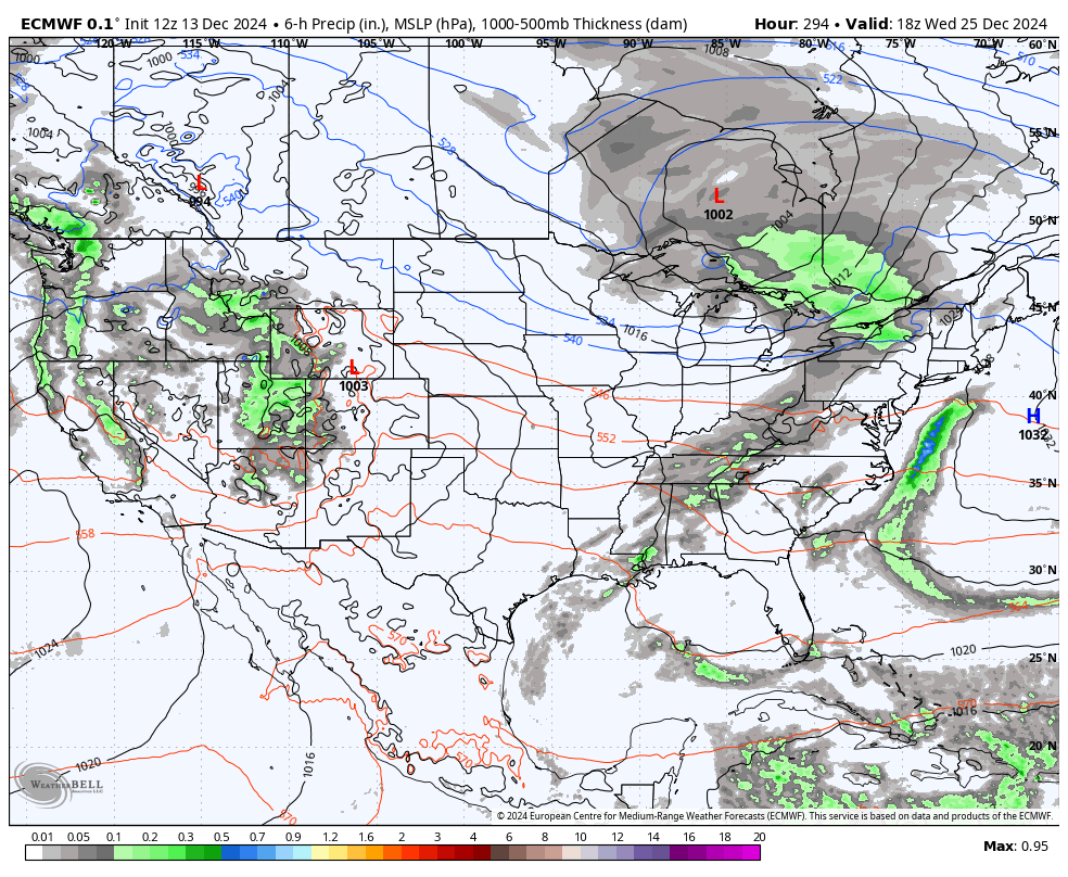
EARLY LOOK AT CHRISTMAS: Well, we are still well out of the forecast range for a good, detailed forecast for Christmas day. Unfortunately, the European model shows some showers possible, while the GFS has a dome of high pressure over us, keeping us dry. We’ll be able to get that refined as we continue to get closer to that time.
SEVERE WEATHER SAFETY
Weather can be unpredictable, often catching us off guard with sudden changes. From thunderstorms and tornadoes to flash floods, being prepared can truly save lives. Alabama’s varied climate brings its share of severe weather, making it crucial for everyone to have a solid safety plan in place. For valuable tips on staying safe when severe weather threatens, check out our Severe Weather Safety Guide. Stay ready, stay safe!
BEACH FORECAST
Visit our Beach Forecast Center to get the latest weather and rip current forecasts for beaches from Fort Morgan to Panama City. This page allows you to select forecasts tailored to your destination, ensuring you have the most accurate and relevant information for your beach plans. Stay informed and safe on your coastal getaway!
ADVERTISE ON THE BLOG
Don’t miss this opportunity! Let us create a customized package tailored to the unique needs of your organization. Our solutions are creative, flexible, and competitively priced. For more information or inquiries, please contact Bill Murray at (205) 687-0782.
E-FORECAST SIGN UP
Get the Alabama Weather Blog’s comprehensive Seven-Day Forecast delivered straight to your inbox twice daily. Known as the most detailed forecast available in Central Alabama, our service ensures you’re always informed and prepared. Subscribe now and gain access to this valuable resource for free!
Category: Alabama's Weather, ALL POSTS, Social Media, Weather Xtreme Videos
About the Author (Author Profile)
Scott Martin is an operational meteorologist, professional graphic artist, musician, husband, and father. Not only is Scott a member of the National Weather Association, but he is also the Central Alabama Chapter of the NWA president. Scott is also the co-founder of Racecast Weather, which provides forecasts for many racing series across the USA. He also supplies forecasts for the BassMaster Elite Series events including the BassMaster Classic.Subscribe
If you enjoyed this article, subscribe to receive more just like it.


