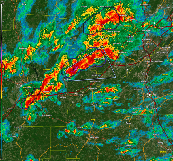
Strong Storm Moving from Eastern Tuscaloosa County into Jefferson County
We are tracking strong storms this morning southwest of Birmingham.
They are not severe, but could produce wind gusts to 40 mph as they move northeast across the Birmingham Metro area. Heavy rain will also impact rush hour traffic. Slow down and give yourself extra time to arrive.
There is a severe weather threat today across the southern half of the south, south of a line from Livingston to Clanton to Roanoke.
A slow-moving cold front stretches from southwest Louisiana to northeast Mississippi, with increasing storm activity near the boundary in a moist air mass. Dewpoints are in the upper 60s to near 70°F, with marginal instability (MUCAPE 500-1000 J/kg) and 0-1 km shear of 100-150 m²/s². While instability limits long-lived supercell potential, conditions support a low risk for brief tornadoes or damaging wind gusts, particularly within stronger storm outflows as activity moves into western Alabama.
Strong storms in southeastern Mississippi are being watched carefully as they approach southwestern Alabama this morning. A brief tornado is not out of the question south of Demopolis to Chatom and Jackson for the next few hours.
Category: Alabama's Weather, ALL POSTS, Social Media


