Rain At Times Through Tomorrow; A Few Thunderstorms
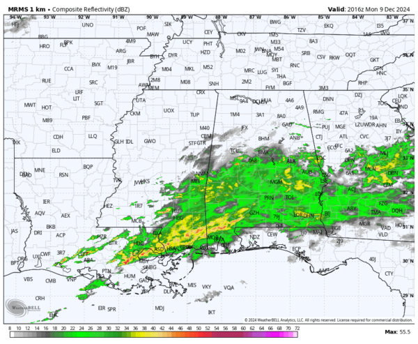
RADAR CHECK: Rain is widespread over the southern half of Alabama this afternoon as a wet pattern continues across Alabama and the Deep South. Temperatures are in the 60s statewide.
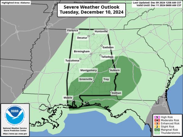
An approaching upper trough and cold front will bring occasional rain to the state through tomorrow night. A few thunderstorms are possible as well… in fact SPC has defined a low end “marginal risk” (level 1/5) of severe thunderstorms tomorrow for a decent part of South Alabama.
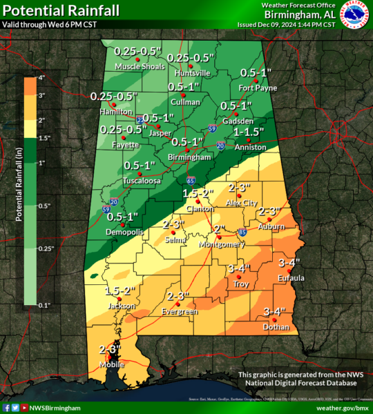
Heavier storms across South Alabama tomorrow could produce strong gusty winds and possibly some small hail. A brief, isolated tornado is possible, but not likely. Additional rain amounts through tomorrow night will generally be 1/2 to 1 inch over the northern counties, with 2-3 inches to the south. Isolated spots across Southeast Alabama could see up to 4 inches of rain.
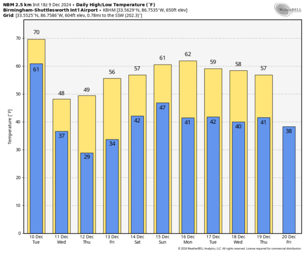
COLDER: Wednesday will be a breezy and much colder today with a clearing sky. After highs in the 60s today and tomorrow, temperatures won’t get out of the 40s Wednesday over the northern half of Alabama with a chilly north wind. A freeze is likely early Thursday morning for the northern and central counties. Thursday and Friday will be dry with a slow warming trend; highs return to the 50s statewide Friday.
THE ALABAMA WEEKEND: Clouds return to the state, and we will have a chance of some rain over the weekend. Models are not in good agreement, but at the moment it looks like rain amounts will be fairly light, and the sun could peek out at times. Highs over the weekend will be in the 55-62 degree range for most communities.
We don’t expect any cold air shots the following week; temperatures will likely stay above freezing December 16-20. See the video briefing for maps, graphics, and more details.
ON THIS DATE IN 2003: Although it never threatened land, a subtropical storm became Tropical Storm Peter approx. 700 miles WNW of the Cape Verde Islands. Combined with Tropical Storm Odette from earlier in the month, this is the first time since 1887 that two tropical storms formed in the Atlantic Basin in December.
ON THIS DATE ONE YEAR AGO: A late night squall line moved through Alabama with areas of straight line wind damage and a few isolated tornadoes. Two of them touched down in the Birmingham metro just after midnight, both rated EF-1. The first one was down for only three minutes, but it moved through a densely populated part of Homewood. The second one was down for two minutes, and touched down near Brookwood Village in a small part of Homewood and Mountain Brook. Thankfully there were no injuries or fatalities.
Look for the next video briefing here by 6:00 a.m. tomorrow…
Category: Alabama's Weather, ALL POSTS, Weather Xtreme Videos


