Midday Nowcast: Wet is the Word; Turning Much Colder Midweek
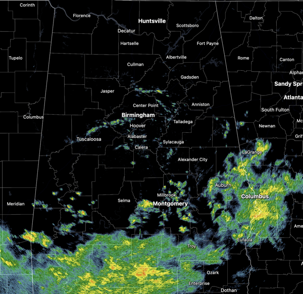
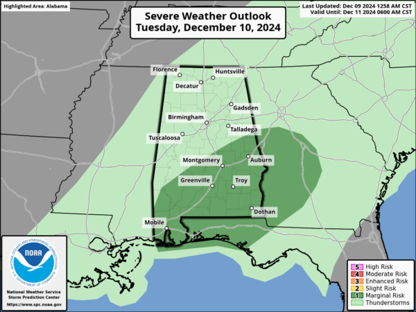
WET IS THE WORD: Much needed rain is in the forecast for Alabama to start this week. It has been wet this morning and we continue to see areas of rain across Alabama at the midday hours. The main area of rain at this hour is over the southern sections of the state. Over the next 36 hours, an approaching upper trough and cold front will bring occasional rain to the state through tomorrow night. A few thunderstorms are possible as well… in fact SPC has defined a low end “marginal risk” (level 1/5) of severe thunderstorms tomorrow for a decent part of South Alabama.
Stronger storms across South and East Alabama tomorrow could produce strong gusty winds and possibly some small hail. A brief, isolated tornado is possible, but not likely. Rain amounts through tomorrow night will generally be in the 1-2 inch range over the northern counties, with 2-3 inches to the south; isolated spots across Southeast Alabama could see up to 4 inches of rain.
BIRMINGHAM ALMANAC: For December 9th, the average high for Birmingham is 58° and the average low is 39°. The record high is 74° set in 1946, while the record low is 9° set in 1917. We average 0.15” of precipitation on this date, and the record value is 2.08” set in 1953.
COLDER AIR RETURNS: Behind the front, Wednesday will be a breezy and much colder day with gradually clearing sky. Temperatures will be in the 40s and with the wind, it will feel much colder. By Thursday morning a freeze is expected. Thursday and Friday will be dry with a slow warming trend; highs Thursday will be in the 40s and return to the 50s statewide Friday.
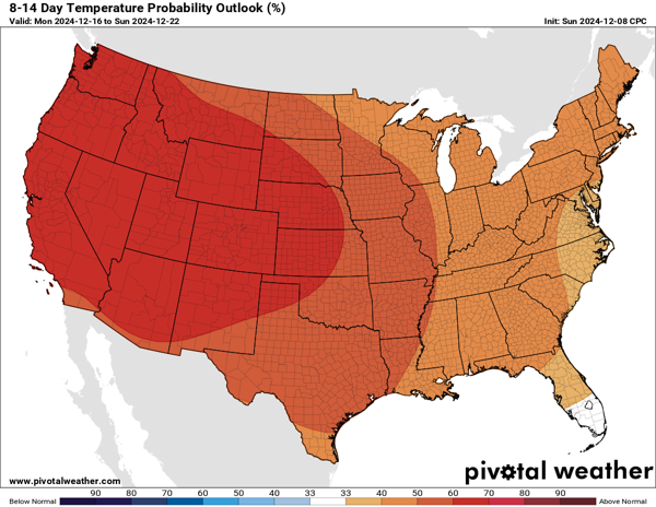
WET WEEKEND WEATHER: Clouds return to the state, and we will have rain at times over the weekend. Still some uncertainties with the timing, but for now, the forecast shows the highest chance of rain will come late Saturday, Saturday night, and into part of the day Sunday. Rainfall totals around one inch are possible. Highs this weekend will be near seasonal average with upper 50s and lower 60s. As we approach the week before Christmas, the long range temperature outlook shows above average temperatures are expected for much of the U.S.
WORLD TEMPERATURE EXTREMES: Over the last 24 hours, the highest observation outside the U.S. was 117.5F at Thabazimbi, South Africa. The lowest observation was -55.7F at Suhana, Russia.
CONTIGUOUS TEMPERATURE EXTREMES: Over the last 24 hours, the highest observation was 81F at Glamis, CA. The lowest observation was -13F at Gunnison, CO.
Category: Alabama's Weather, ALL POSTS, Social Media


