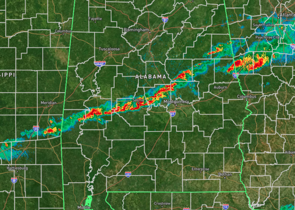
The 5AM Weather Check
The line of storms has made it southward and now stretches from Butler to Selma to Alexander City to Wedowee, and so far, the line has behaved on its path through the state. The severe weather threat has ended for those north of the line of storms.
Instability values have increased over the southern half of the state, especially along and south of the line of storms, especially around the Montgomery, Eclectic, Auburn, and Tuskegee areas. This is also where the higher Significant Tornado Parameter values are located, reaching 2, while nearly the rest of South Alabama is at 1 or below. However, helicity over much of Alabama is now too weak to support rotating updrafts. Only those locations mentioned have the helicity values high enough to be supportive.
Timing for the severe threat has been shortened a little as the line has been moving a little quicker. From now through 9AM for locations along and ahead of the line of storms. Once the line passes your location, the threat is over. Hail has been completely removed as a threat, but isolated tornadoes and damaging wind gusts continue.
As for me, this is my last post for this event, so have a Happy Thanksgiving! Be safe out there today, and remember, today is not the day to be experimenting on new recipes in the kitchen to try out on your family.
Category: Alabama's Weather, ALL POSTS, Severe Weather, Social Media


