Rain & Storms Staying Below Severe Criteria As We Approach 2AM
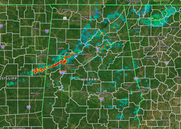
A line of rain and storms are approaching the cities of Aliceville and Tuscaloosa as I type with heavy rainfall and some breezy winds. However, these storms are staying below severe criteria, and even special weather statement criteria for the moment. If this line of storms have already passed over your location, the severe weather threat is over, and you can rest easy for the rest of the overnight hours. East of this line, we have some scattered showers and storms, but these are even weaker than the ones in the line, with light to moderate rainfall and some small pockets of heavy rainfall.
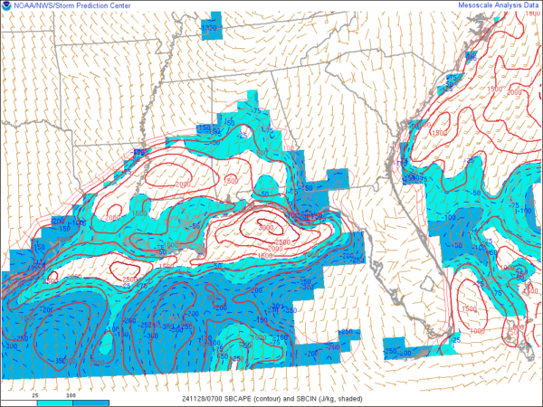
Instability has started to increase across the southern half of the state, especially along the I-65 corridor and west. We may see the line of storms begin to increase in intensity over the next few hours as this instability will give these storms the lift needed for that intensification. A Significant Tornado Parameter of 1 now exist for those locations I just mentioned with the increased instability, and tops out at a 2 over the southwestern parts of Central Alabama and the northwestern parts of South Alabama. Helicity and wind shear values are high enough to be supported of spinning updrafts if they occur, so we will need to watch those locations carefully over the next few hours.
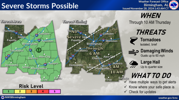
NWS Birmingham has just released their latest update to their severe weather timing as I was typing this post, and the threat for the northwestern 1/3rd of the area is over. The threat continues from now until 6AM for the central 1/3rd, and from 5AM to 10 AM for the southeastern 1/3rd. Isolated, brief tornadoes, damaging wind gusts up to 60 mph, and large hail up to 1 inch in diameter remain the potential threats in the risk locations.
I’ll be here throughout the remainder of the overnight and pre-dawn hours until 5AM. Remember to keep those weather warning sources close by until the line passes your location.
Category: Alabama's Weather, ALL POSTS, Severe Weather, Social Media


