A Pre-Midnight Look at Our Weather Situation
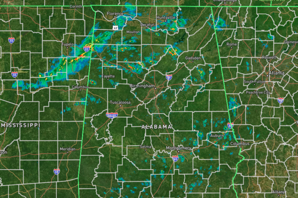
As we are making our way to the midnight hour just before we yell out, “gobble, gobble” and feast on our favorite Thanksgiving foods, we do have to get through our little severe weather threat from now through the pre-dawn hours. Radar currently shows spotty showers over the southern portions of the state, mainly over and around the I-85 and I-65 corridors, while in the northern half, we have a line of rain and perhaps some embedded thunder moving into the northwestern portions of Central Alabama, with a few rain clusters several miles out ahead of the line. At this point, everything is staying well-behaved, and no watches or warnings are currently in effect.
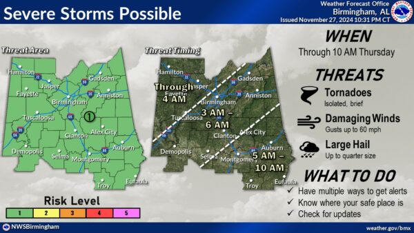
NWS Birmingham has laid out their latest severe weather timing and threat graphic, and it shows for the northwest 1/3rd of the area, the threat is from now through roughly 4AM. For the central third, 3AM through 6AM. And for the southeastern 1/3rd, 5AM through 10AM. If you were to stretch that up into the Tennessee Valley, roughly the timing would be from now through 4AM. Threats will be from brief, isolated tornadoes (very small risk), damaging wind gusts up to 60 mph, and large hail up to 1 inch in diameter.
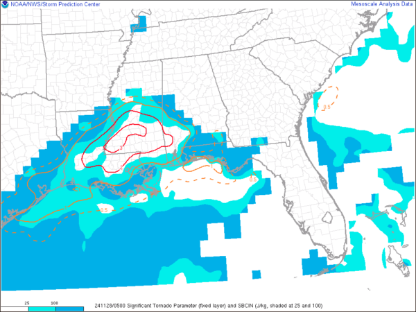
 Current Significant Tornado Parameter
Latest mesoscale analysis shows virtually no instability over north and central Alabama at this point, with values starting over the southwestern counties and increasing as you move west and southwest. We do have a good amount of wind shear available in the low and mid-levels, along with very good helicity in place. However, with the instability being disjointed to the southwest of those better ingredients, the better tornado threat is currently located over southern Mississippi. Latest trends are showing the instability being confined to locations along and south of the I-20 and I-20/59 corridors as we move through the overnight and into the pre-dawn hours.
Latest update from NWS Birmingham: “Currently watching a developing line of thunderstorms over Mississippi as it pushes eastward toward Central Alabama. The line is expected to intensify somewhat as it approaches the I-65 corridor from Birmingham southward by around 2-4 am. A warm front moving northward across the area has raised temperatures across our southwest, areas such as Demopolis, Selma, and Tuscaloosa from the mid 50s to the mid to upper 60s in just two to three hours. As this advancement continues northward, a nose of 500-700 J/kg of SBCAPE is progged to creep up the I-59 corridor ahead of the incoming line. Coupled with 45-55 kts of effective bulk shear and 0-1 km SRH of 200-300 m2/s2, a sufficient high shear, low CAPE setup will need to be monitored closely for the potential for brief tornadoes within the line as it passes through. Hail should be less of a concern with the low-topped and linear nature of the storms, although mid-level lapse rates up to 7 C/km are somewhat favorable. High-res CAMs such as the HRRR indicate the line will begin to lose steam as it reaches the I-85 corridor around 6 am. The line orientation will become more ENE-WSW with time as it exits our southeastern counties by 9-10 am.”
We’ll be with you through the overnight hours. Keep your trusted weather warning sources close by just in case a warning is issued for your location.
Category: Alabama's Weather, ALL POSTS, Severe Weather, Social Media


