From Sunshine to Showers: Alabama’s Weather Will Shift This Week
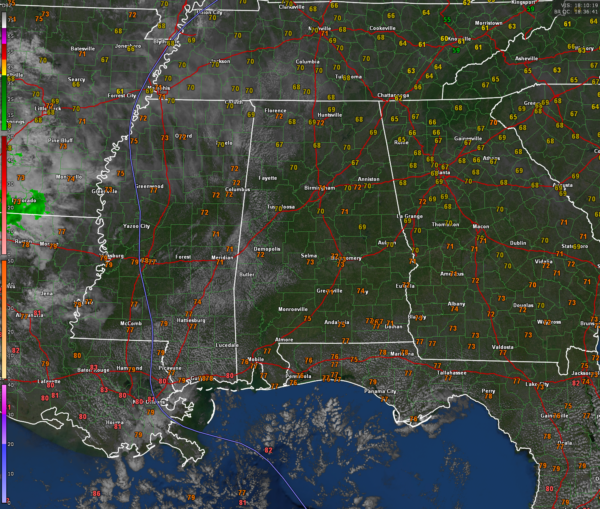
Sunny skies dominate Central Alabama this afternoon, with temperatures comfortably climbing into the lower to mid-70s. Light south winds at 5 mph accompany the pleasant conditions, making for a calm and inviting Sunday. High pressure centered over the Ohio Valley is the driving force behind today’s tranquil weather, but changes are on the horizon as the pattern shifts early this week.
Tonight, expect partly cloudy skies with lows dipping into the upper 40s across much of the region. Winds will turn southeasterly and remain light, setting the stage for a slightly warmer day on Monday. Sunshine will return for most of the day Monday, pushing highs into the mid-70s, with a steady southeast breeze between 5 to 10 mph. Increasing clouds late in the day will signal the approach of a dynamic system that promises to bring wet and breezy conditions by Monday night.
By late Monday night, showers and isolated thunderstorms are expected to develop across Central Alabama, with the rain becoming more widespread by Tuesday morning. Lows will stay mild, only falling into the lower 60s overnight. The incoming system, associated with a cold front and a potent upper-level disturbance, will bring gusty winds up to 25 mph and locally heavy rain through the day Tuesday. Highs will hover in the upper 60s, though much of the day will feel damp and breezy. Rainfall amounts of 1-2 inches are possible, particularly south of I-20, but the risk of severe storms remains low as instability appears confined to the Gulf Coast.
Showers will taper off Tuesday night, giving way to drier air by Wednesday morning. Cooler air will filter into the state as the front moves east, with highs falling into the mid-60s Wednesday under sunny skies. By Wednesday night, a sharp drop in temperatures will bring lows into the upper 30s, marking the beginning of a crisp, fall-like pattern for the latter half of the week. Frost potential will increase each night as the dry air settles over the region.
Looking ahead, high pressure will return for the end of the week, providing abundant sunshine and cooler temperatures. Highs in the mid-50s and lows in the mid-30s will persist through Friday, with a gradual warming trend expected by next weekend. With frost possible during the early morning hours Friday and Saturday, this week will provide a clear reminder that winter is just around the corner.
Category: Alabama's Weather, ALL POSTS, Social Media


