Tropical Storm Sara Moves Inland…Moisture Could Enhance Rainfall Along Gulf Coast This Week
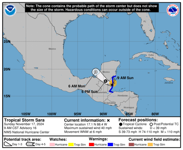
Tropical Storm Sara made landfall near Dangriga, Belize, earlier this morning with maximum sustained winds of 40 mph. Though the system showed a brief convective resurgence before landfall, including bursts of deep convection and lightning, it has continued to weaken as it moves inland. The tropical storm is expected to degenerate into a trough of low pressure later tonight or early Monday as it crosses the Yucatan Peninsula. Tropical storm conditions will persist in portions of the warning area, including Belize, the Caribbean coast of Guatemala, and parts of Mexico’s Quintana Roo state, for the next several hours.
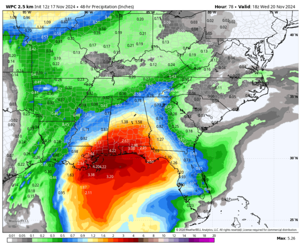
Sara has produced exceptional rainfall totals, particularly in northern Honduras, where over 40 inches of rain have been reported in some areas. This heavy rainfall is now shifting westward across Belize, eastern Guatemala, and the Yucatan Peninsula, bringing significant risks of flash flooding and mudslides. Although rainfall in northern Honduras is tapering off, catastrophic flooding impacts remain possible in the region’s hardest-hit areas. Meanwhile, as Sara’s remnants move into the Gulf of Mexico, a plume of tropical moisture could enhance rainfall along portions of the U.S. Gulf Coast, from Louisiana to the Florida Panhandle, by Tuesday.
Here are rainfall totals from the WPC through Wednesday at noon:
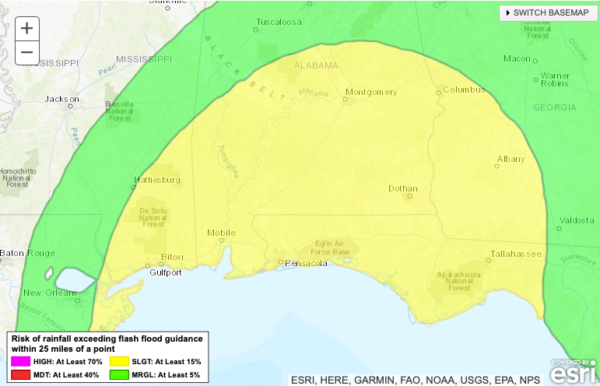
The WPC does have parts of the northern Gulf Coast including the southern third of Alabama in a slight risk for excessive rainfall in the day three period (Tuesday).
Category: Alabama's Weather, ALL POSTS, Social Media, Tropical


