Midday Nowcast: Phenomenal Fall Weather through the Weekend
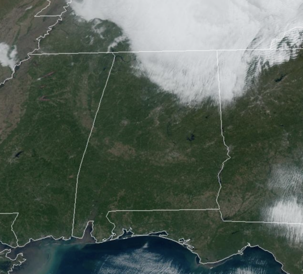
PHENOMENAL FALL WEATHER: The clouds over northern sections of Alabama will mix out the rest of today. Today and through the weekend, expect sunny pleasant days and clear chilly nights. Highs today are in the 60s, and lower 70s are expected both tomorrow and Sunday. Lows drop into the 40s, and some colder spots over North Alabama could reach the 30s early tomorrow morning.
FRIDAY NIGHT LIGHTS: A perfect night for high school playoff games tonight. A clear sky with temperatures falling through the 50s.
BIRMINGHAM ALMANAC: For November 15th, the average high for Birmingham is 65° and the average low is 43°. The record high is 81° set in 1978, while the record low is 19° set in 1940. We average 0.14” of precipitation on this date, and the record value is 1.77” set in 1930.
ACROSS THE USA: Gusty winds and low relative humidity will bring critical fire weather to parts of southern New England and Hawaii Friday where Red Flag Warnings have been issued. Several feet of snow may accumulate over the Cascades from late Friday night into Monday evening as a storm system move through the Pacific Northwest.
FOOTBALL WEATHER: Tomorrow, Auburn hosts LA-Monroe at Jordan-hare Stadium (11:45a CT kickoff)… expect a sun filled sky with temperatures rising from the mid 60s at kickoff, to near 70 by the final whistle.
Tomorrow, Alabama hosts Mercer (1p CT kickoff) at Bryant-Denny Stadium/Saban Field. The sky will be sunny with temperatures in the 67-70 degree range.
UAB plays at Memphis tomorrow night (7p CT kickoff). The sky will be clear with temperatures falling from the low 60s at kickoff into the low 50s by the fourth quarter.
INTO NEXT WEEK: The quiet weather continues Monday, but a sharp cold front will bring rain and storms back to Alabama Tuesday into Wednesday. Behind the front, much colder air so far this season will blow into Alabama Thursday as highs will fall into the 50s, while lows return to the 30s, with some 20s likely.
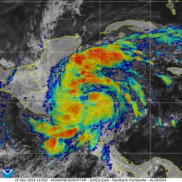
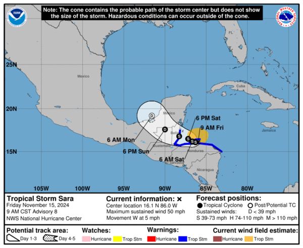
TROPICAL STORM SARA: Sara is moving toward the west near 5 mph. A continued slow westward motion is expected over the next day or so, but a west-northwestward motion is forecast to begin by late Saturday. On the forecast track, the center of Sara will continue to move close to the northern coast of Honduras through early Saturday before approaching Belize, and ultimately moving onshore in Belize during the day on Sunday. Maximum sustained winds are near 50 mph with higher gusts. Some slight strengthening is possible over the next couple of days as long as Sara remains offshore of the coast of Honduras. Tropical-storm-force winds extend outward up to 115 miles from the center. The estimated minimum central pressure is 997 mb (29.44 inches).
Sara is unlikely to survive its trek across the Yucatan Peninsula, some leftover low-level vorticity from Sara’s remnants should merge with an elongated trough or front over the Gulf of Mexico by the middle of next week. Given the strong wind shear and cooler waters, no tropical redevelopment is expected over the Gulf of Mexico.
WORLD TEMPERATURE EXTREMES: Over the last 24 hours, the highest observation outside the U.S. was 110.7F at Vioolsdrif, South Africa. The lowest observation was -66.3F at Dome A, Antarctica.
CONTIGUOUS TEMPERATURE EXTREMES: Over the last 24 hours, the highest observation was 89F at Catalina Foothills, AZ. The lowest observation was 4F at Mackay, ID.
Category: Alabama's Weather, ALL POSTS, Social Media


