Midday Nowcast: Clouds and Rain have Returned to North/Central Alabama
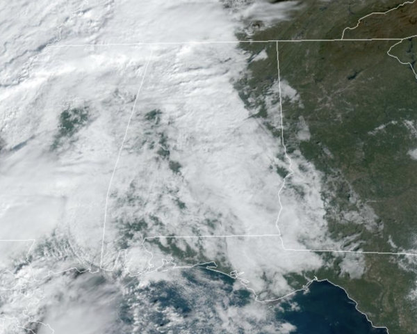
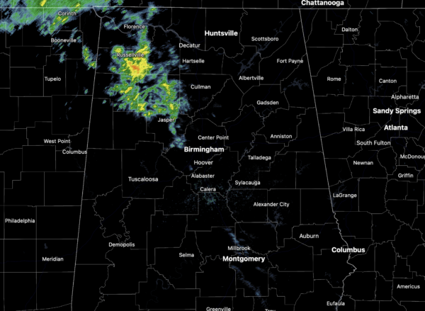
INCREASING RAIN TODAY: Clouds have returned to Alabama today and those clouds are bringing some much needed rain. Scattered rain showers will become more widespread this evening and overnight.
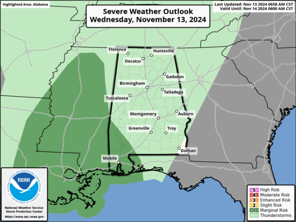
We have the potential to get 1/2 to 1 inch the next 24 hours, certainly no drought buster, but any rainfall at the point is a welcomed sight. We note SPC maintains a “marginal risk” of severe thunderstorms for the southwest corner of Alabama late today and tonight…stronger storms there could produce strong, gusty winds. A brief, isolated tornado can’t be totally ruled out.
Highs today are in the 60s, and we can expect those tomorrow as well with a clearing sky by the end of the day.
BIRMINGHAM ALMANAC: For November 13th, the average high for Birmingham is 66° and the average low is 43°. The record high is 82° set in 1938, while the record low is 18° set in 2019. We average 0.14” of precipitation on this date, and the record value is 1.39” set in 1986.
ACROSS THE USA: Red Flag Warnings have been reissued today for southern New England due to more critical fire weather from gusty winds and dry fuels. An Atmospheric River will bring a marginal risk for heavy to excessive low elevation rain and mountain snow to the Pacific Northwest and northern California today into at least Thursday night.
FRIDAY AND THE WEEKEND: This weekend will feature phenomenal fall weather across Alabama with sunny pleasant days and clear chilly nights. Highs will be in the 60s Friday, and likely lower 70s both Saturday and Sunday. Lows drop into the 40s, and some colder spots over North Alabama could reach the 30s early Saturday morning.
FOOTBALL WEATHER: A perfect night for high school playoff games Friday night. A clear sky with temperatures falling through the 50s.
Saturday, Auburn hosts LA-Monroe at Jordan-hare Stadium (11:45a CT kickoff)… expect a sun filled sky with temperatures rising from the mid 60s at kickoff, to near 70 by the final whistle.
Saturday, Alabama hosts Mercer (1p CT kickoff) at Bryant-Denny Stadium/Saban Field. The sky will be sunny with temperatures in the 67-70 degree range.
UAB plays at Memphis Saturday night (7p CT kickoff). The sky will be clear with temperatures falling from the low 60s at kickoff into the low 50s by the fourth quarter.
INTO NEXT WEEK: The quiet pattern looks to continue into at least the first half of next week as the weather stays dry and seasonable. However, a dynamic weather system will bring some risk of rain and thunderstorms to the Deep South by Thursday ahead of a cold front. Behind the front, much colder air will blow into Alabama as highs will fall into the 50s, while lows return to the 30s.
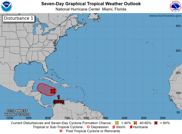
SOON TO BE SARA: Invest 99L is a broad area of low pressure over the central Caribbean Sea continues to produce a large area of showers and thunderstorms. Environmental conditions are conducive for development, and a tropical depression is likely to form within the next couple of days while the system moves slowly westward into the western Caribbean Sea. Afterward, further development is likely while the disturbance meanders over the western Caribbean Sea through the weekend. The system is expected to turn slowly northwestward by early next week. Interests across the western and northwestern Caribbean Sea should monitor the progress of this system. Regardless of development, heavy rains are expected over Jamaica during the next day or so. An Air Force Hurricane Hunter aircraft is scheduled to investigate this system later today. Formation chance high…90%
Most global models suggest Sara could become a hurricane over the southern Gulf of Mexico, and most of the ensemble members bring it into South Florida somewhere south of Tampa Bay by the middle of next week. Remember we always say we have to wait until the system actually develops, gets a good core, and we get dropsonde data from hurricane hunters, before we won’t know the track or intensity. Confidence is high (based on the forecast upper air pattern) that this tropical system won’t impact the Central Gulf Coast (Gulf Shores to Panama City Beach).
WORLD TEMPERATURE EXTREMES: Over the last 24 hours, the highest observation outside the U.S. was 114.6F at Marble Bar, Australia. The lowest observation was -67.4F at Dome A, Antarctica.
CONTIGUOUS TEMPERATURE EXTREMES: Over the last 24 hours, the highest observation was 94F at Rio Grande Village, TX The lowest observation was 0F at Peter Sinks, UT.
Category: Alabama's Weather, ALL POSTS, Social Media


