Midday Nowcast: Sunshine and Blue Sky for the Northern Two-Thirds of Alabama
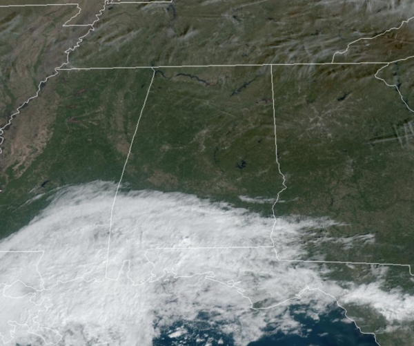
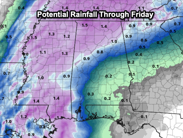
Today is a sunny and dry day for most of Alabama, but clouds linger across southern sections of the state. Highs this afternoon are ranging from the low to upper 70s across the state. Tomorrow, a cold front will dive south, bringing the chance of rain statewide tomorrow afternoon, night, and into early Thursday. This system has potential to bring some much needed rain to Alabama with 1/2 to 1 inch possible.
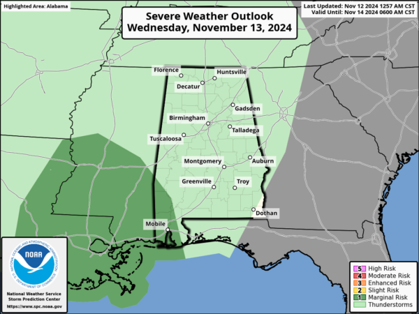
Any rainfall at the point is a welcomed sight with the ongoing drought across the state. We note SPC has defined a “marginal risk” of severe thunderstorms for the southwest corner of Alabama late tomorrow and tomorrow night…stronger storms there could produce strong, gusty winds. A brief, isolated tornado can’t be totally ruled out.
Temperatures tomorrow and Thursday won’t get out of the 60s.
BIRMINGHAM ALMANAC: For November 12th, the average high for Birmingham is 66° and the average low is 44°. The record high is 82° set in 1985, while the record low is 22° set in 2019. We average 0.14” of precipitation on this date, and the record value is 4.04” set in 1935.
FRIDAY AND THE WEEKEND: This weekend will feature phenomenal fall weather across Alabama with sunny pleasant days and clear chilly nights. Highs will be in the 60s Friday, and likely lower 70s both Saturday and Sunday. Lows drop into the 40s, and some colder spots over North Alabama could reach the 30s early Saturday morning.
INTO NEXT WEEK: The quiet pattern looks to continue into at least the first half of next week as the weather stays dry. A dynamic weather system will bring some risk of rain and possible thunderstorms to the Deep South by Thursday night and Friday. Way too early to know if severe storms or heavy rain will be involved, but just something to watch late next week.
IN THE TROPICS: A tropical wave over the central Caribbean Sea is producing an area of disorganized showers and thunderstorms. Environmental conditions appear conducive for development, and a tropical depression is likely to form by the end of the week as the system moves slowly westward into the western Caribbean Sea. Afterward, the disturbance is expected to meander over the western Caribbean Sea through the weekend and begin moving slowly, generally northwestward, by early next week. Interests across the western Caribbean Sea should monitor the progress of this system. Formation chance through 48 hours…Medium…40 percent. Formation chance through 7 days…high…80 percent. The next same up is Sara.
Many of the global model ensemble members suggest it could enter the far southern Gulf of Mexico before turning northeast, meaning some possible impact for South Florida in 7-10 days, but of course it is way to early to know the track or intensity.
WORLD TEMPERATURE EXTREMES: Over the last 24 hours, the highest observation outside the U.S. was 113.4F at Qairoon Hairiti, Oman. The lowest observation was -67.7F at Dome A, Antarctica.
CONTIGUOUS TEMPERATURE EXTREMES: Over the last 24 hours, the highest observation was 97F at Faith Ranch, TX. The lowest observation was 4F at Angel Fire, NM.
Category: Alabama's Weather, ALL POSTS, Social Media


