Midday Nowcast: Clearing Sky this Afternoon; Midweek Front Brings Wonderful Weekend Weather
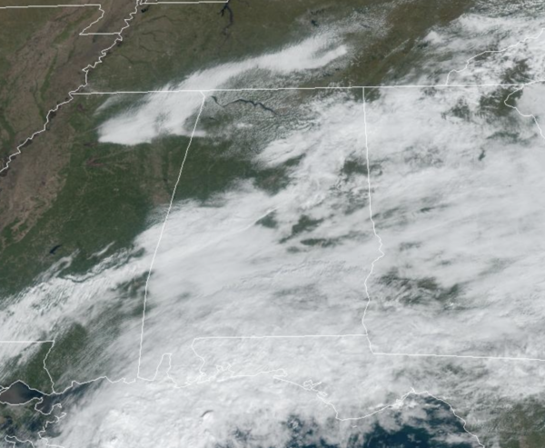
Gradual clearing across North/Central Alabama for the rest of our Veterans Day, and spotty showers from the morning should be confined to southern sections of the state the rest of today. Temperatures this afternoon are about 10 degrees above average with mid 70s in many locations. Tonight will feature a mainly clear sky with chillier temperatures as upper 40s and lower 50s return.
BIRMINGHAM ALMANAC: For November 11th, the average high for Birmingham is 66° and the average low is 44°. The record high is 84° set in 1896, while the record low is 25° set in 1926. We average 0.13” of precipitation on this date, and the record value is 3.81” set in 1929.
ACROSS THE USA: A cold front will work across the Eastern U.S. through Monday with scattered rain showers and thunderstorms before broad high pressure brings quiet weather by Tuesday. Across the Western U.S., a cold front will shift across the region through Tuesday. An Atmospheric River following the front will bring heavy coastal rain and high elevation snowfall to portions of the Northwest.
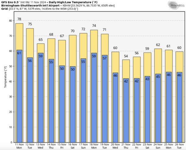
Tomorrow will be a mostly sunny and dry day for most of Alabama with highs ranging from the low to upper 70s. On Wednesday, a cold front will dive south and bring the chance of rain statewide Wednesday afternoon, night, and into early Thursday. This system has potential to bring some much needed rain to Alabama with 1/2 to 1 inch possible. Any rainfall at the point is a welcomed sight with the ongoing drought across the state. Highs Wednesday could climb to near 70° before the front moves through, but on Thursday temperatures won’t get out of the 60s.
FRIDAY AND THE WEEKEND: This weekend will feature phenomenal fall weather across Alabama with sunny pleasant days and clear chilly nights. Highs will be in the 60s Friday, and close to 70° both Saturday and Sunday. Lows drop into the 40s, and some colder spots over North Alabama could reach the 30s early Saturday morning. The quiet pattern looks to continue into at least the first half of next week.
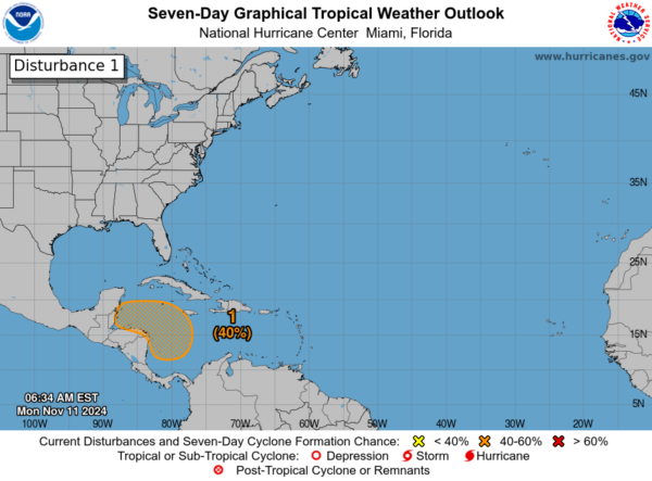
IN THE TROPICS: A broad area of low pressure is expected to form over the western Caribbean Sea during the next couple of days. Environmental conditions appear conducive for some gradual development of this system thereafter, and a tropical depression could form late this week or this weekend while moving slowly westward. Formation chance through 7 days…medium…40 percent. The next same up is Sara.
WORLD TEMPERATURE EXTREMES: Over the last 24 hours, the highest observation outside the U.S. was 111.7F at Marble Bar, Australia. The lowest observation was -67.7F at Dome A, Antarctica.
CONTIGUOUS TEMPERATURE EXTREMES: Over the last 24 hours, the highest observation was 95F at Faith Ranch, TX. The lowest observation was 5F at Alamosa, CO.
Category: Alabama's Weather, ALL POSTS, Social Media


