A Few Showers at Times Through the Weekend & the Start of Next Week
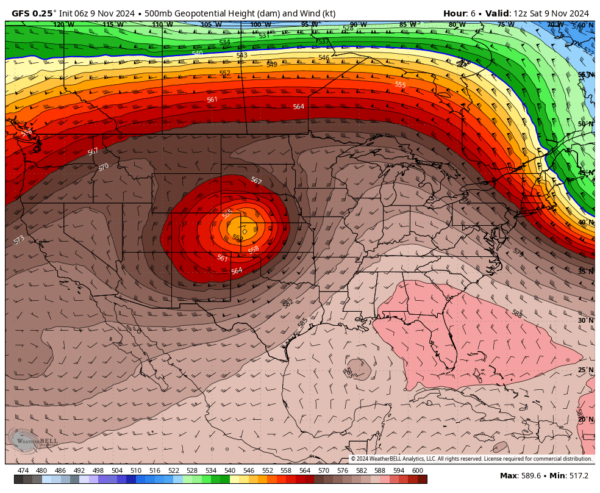
We begin the morning with a ridge of high pressure over the Southeast and a low-pressure system approaching from the west, bringing a cold front toward the region. Moisture-laden air will continue to move into the area, leading to a chance for scattered showers throughout the morning. As daytime heating progresses, rain chances will slightly increase, with isolated thunderstorms possible, particularly along and north of I-59. Rainfall is most likely in the northwest part of the state, with diminishing chances toward the southeast. Highs will range from the lower 70s to the lower 80s.
On Sunday, as the front approaches, daytime heating will trigger additional scattered showers and thunderstorms, especially north of I-59, with a few storms possible to the south. This is not expected to be a severe weather event. Highs will remain in the 70s.
After the front passes, a zonal flow will establish over the country on Monday. However, we’ll still experience mostly cloudy conditions with a few lingering showers across the state. Temperatures will stay between the lower 70s and lower 80s.
By Tuesday, ridging will begin to build again over the southern U.S., shifting our flow to the northwest, which will usher in drier conditions and bring back mostly sunny skies. Highs will be in the 70s.
On Wednesday, the ridge broadens, and another cold front approaches, expected to pass through the area during the evening and overnight hours. While a brief, isolated shower cannot be completely ruled out, most locations will remain dry. Highs will range from the lower to mid-70s.
Thursday will see northwest flow re-establish, reinforcing cooler, dry air across the state. Highs will be in the mid-60s to mid-70s.
By Friday, we can expect continued dry and pleasant conditions, with highs in the mid-60s to lower 70s, as seasonable temperatures settle in.
In the tropics…
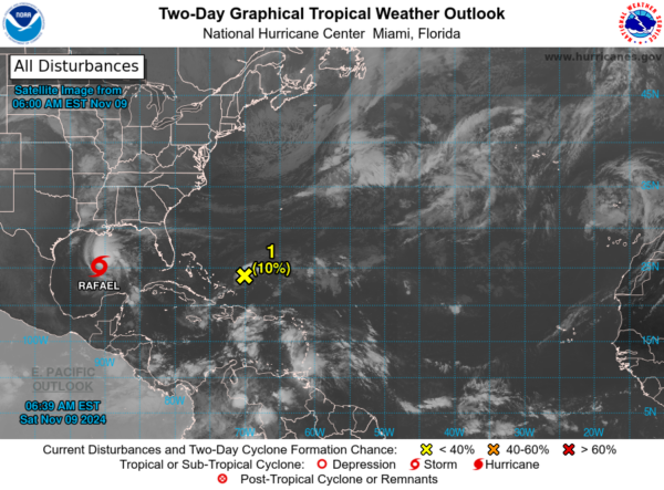
Tropical Storm Rafael continues its slow westward motion but will begin turning south-southwestward on Sunday. Currently, winds are at 65 mph, with gradual weakening expected over the next few days.
Additionally, a low-pressure area east of the Bahamas is generating disorganized showers and thunderstorms. As it moves west-northwestward, it may strengthen slightly, but development into a tropical system appears unlikely at this time.
Category: Alabama's Weather, ALL POSTS, Social Media, Tropical, Weather Xtreme Videos


