Midday Nowcast: Higher Rain Chances this Week; Watching Soon to be Rafael to our South
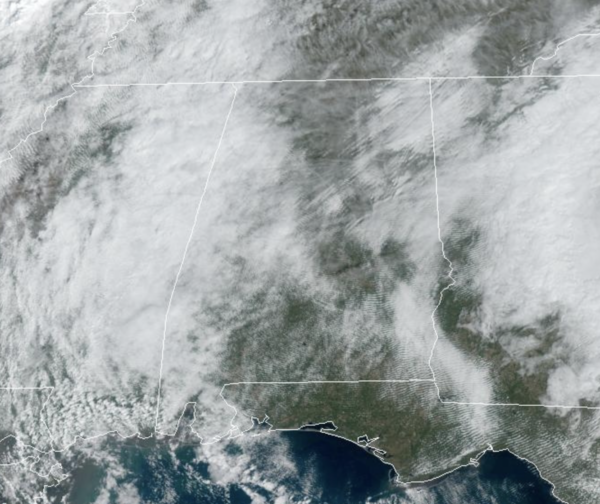
REST OF TODAY: We are seeing a partly sunny sky with temperatures this afternoon in the upper 70s for the northern half of Alabama, with low 80s for the southern counties of the state. It is dry, but there could be some light mist in a few locations.
BIRMINGHAM ALMANAC: For November 4th, the average high for Birmingham is 69° and the average low is 46°. The record high is 82° set in 1909, while the record low is 22° set in 1991. We average 0.13” of precipitation on this date, and the record value is 2.29” set in 1992.
ACROSS THE USA: Scattered severe thunderstorms, associated with tornadoes, large hail, and damaging winds are likely today from the southern Plains into the Ozarks, and mid Mississippi Valley. Excessive rainfall is also likely in these areas. Gusty easterly winds and low relative humidity will support elevated to critical fire weather over coastal portions of California today into Thursday.
ELECTION DAY AND REST OF WEEK: Moisture levels begin to increase in coming days, and we will bring in a chance of scattered showers and thunderstorms tomorrow and each day through Friday as a surface front stalls out just to the northwest. For tomorrow, most of the day looks dry, with only few showers possible for the western counties of the state. Weather will not be an issue for Election Day across the state, so please make sure you cast your vote!!! For Wednesday through Friday, though scattered showers and storms are possible, rain distribution will not be very even as the chance of any one spot will seeing rain will be in the the 40-50 percent range. Temperatures will remain above average with highs ranging from the upper 70s to lower 80s across Alabama.
WEEKEND WEATHER: There is a lot uncertainty due to model differences in handling the tropical system in the Gulf of Mexico. The American GFS model suggests Saturday will be a day with widespread, beneficial rain, while the European global model shows little rain at all as it keeps the tropical system far to the southwest. With any tropical system, as it develops and begins to move, we will have a better understanding of where the system is going and any potential impacts in the coming days. For now we will continue to mention a chance of rain Saturday, with a trend toward drier weather Sunday. Highs over the weekend will be in the 70s.
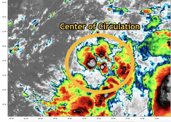
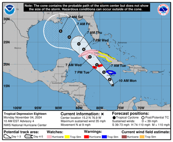
SOON TO BE RAFAEL: At 1000 AM EST, the center of Tropical Depression Eighteen was located near latitude 15.2 North, longitude 76.9 West. The depression is moving toward the north near 9 mph. A northwestward motion is expected to begin later today and forecast to continue for the next few days. On the forecast track, the system is expected to move near Jamaica tonight, be near or over the Cayman Islands on Tuesday, and approach Cuba on Wednesday.
Maximum sustained winds are near 35 mph with higher gusts. Steady strengthening is forecast, and the depression is expected to become a tropical storm later today and a hurricane by Wednesday. The estimated minimum central pressure is 1003 mb (29.62 inches).
The latest NHC forecast track brings it over the western tip of Cuba as a category one hurricane Wednesday, and into the southern Gulf of Mexico Thursday. From there, weakening is likely due to cooler sea surface temperatures and stronger winds aloft, producing shear. It is too early to know if Alabama will see beneficial rain, but we certainly need it and hopefully we will get tome. Again, in the coming days, we will have much better understanding about the system.
WORLD TEMPERATURE EXTREMES: Over the last 24 hours, the highest observation outside the U.S. was 112.3F at Marble Bar, Australia. The lowest observation was -70.6F at Dome A, Antarctica.
CONTIGUOUS TEMPERATURE EXTREMES: Over the last 24 hours, the highest observation was 95F at Laredo, Faith Ranch, and Cotulla, TX. The lowest observation was -6F at Peter Sinks, UT.
Category: Alabama's Weather, ALL POSTS, Social Media, Tropical


