Subtropical Storm Patty Moving Away from the Azores
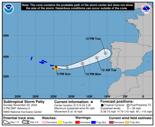
Patty is moving away from the Azores, with its center now east of the furthest islands. The storm has weakened and is showing signs of transitioning to a post-tropical state, as it hasn’t produced any deep convection for more than six hours. Recent satellite data indicates sustained winds of 40-45 mph, primarily impacting areas south of the Azores.
Strong wind shear, cooler sea temperatures, and stable air are working against Patty’s strength, and it’s expected to become post-tropical later today or tonight. The storm will likely dissipate in the next couple of days as it continues its eastward journey at around 16 mph toward western Europe.
Conditions in the Azores should improve soon, though some lingering rainfall of 1-2 inches with isolated amounts up to 4 inches is possible through early Monday, potentially causing localized flooding. Swells from Patty will persist into the evening, bringing dangerous surf and rip currents to the region.
Category: ALL POSTS, Social Media, Tropical


