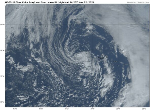
Subtropical Storm Patty Formed Earlier This Morning; Heading for The Azores
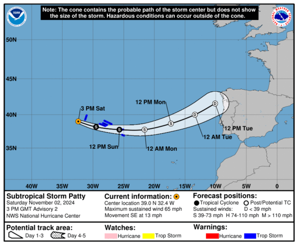
SUMMARY OF 10 AM CDT…1500 UTC…INFORMATION
Location: 39.0°N 32.4°W
About: 300 miles (480 km) WNW of the Azores
Maximum Sustained Winds: 65 mph (100 km/h)
Present Movement: SE at 13 mph (20 km/h)
Minimum Central Pressure: 982 mb (29.00 inches)
WATCHES AND WARNINGS
Tropical Storm Warning in effect for all of the Azores
DISCUSSION AND OUTLOOK
As of 10 AM CDT (1500 UTC), Subtropical Storm Patty is centered near 39.0°N and 32.4°W, moving southeast at 13 mph (20 km/h). A faster eastward motion is expected in the coming days. Patty’s center is forecast to move near or just south of the Azores tonight and into Sunday.
Patty’s maximum sustained winds have increased to 65 mph (100 km/h), with higher gusts. Gradual weakening is anticipated, and Patty is expected to transition into a post-tropical low by Sunday night.
Tropical-storm-force winds extend up to 205 miles (335 km) from the center. The minimum central pressure is estimated at 982 mb (29.00 inches).
HAZARDS AFFECTING LAND
Wind: Tropical storm conditions are expected in the Azores tonight and into Sunday.
Rainfall: Patty is forecast to bring 1 to 2 inches (25 to 50 mm) of rain across the Azores through Sunday.
Surf: Swells generated by Patty will impact the Azores over the next couple of days, producing life-threatening surf and rip current conditions.


