Dry With Some Clouds At Times This Weekend; Tropical Madness Starting to Fire Up in the Caribbean
Today’s Outlook:
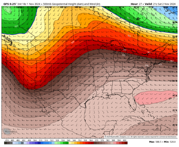
A strengthening ridge of high pressure will dominate the region today, pushing a surface front northward across the southern Tennessee Valley by the afternoon. The day will start with mostly cloudy skies and areas of fog, but expect conditions to improve with partly cloudy skies by the afternoon. Temperatures will rise into the upper 70s to mid 80s, making for a warm and pleasant day.
Football Forecast:
Auburn hosts Vanderbilt at Jordan-Hare Stadium with an 11:45 AM CT kickoff. Sunny skies will prevail, with temperatures climbing from near 78°F at kickoff to the low 80s by the second half.
UAB hosts Tulsa at Protective Stadium in Birmingham at 1:30 PM CT. Expect partly to mostly sunny skies, with temperatures around 80°F during the game.
Troy hosts Coastal Carolina at 3:00 PM CT. Mostly sunny skies will dominate, with temperatures starting near 82°F and falling into the 70s by the fourth quarter.
Sunday Outlook:
Ridging will remain strong across the Southeast, maintaining calm weather with a light southwesterly flow. Expect partly cloudy skies and highs ranging from the lower 70s to the lower 80s.
Early Next Week:
On Monday, high pressure to our east will keep rain out of the forecast, despite increased moisture from the Gulf. Expect a mix of sun and clouds, with highs in the lower 70s to lower 80s. By Tuesday, a weakening cold front approaches from the west, bringing the chance for scattered showers or a storm, particularly in the western and northwestern counties, during the evening and overnight hours. Highs will remain in the mid 70s to mid 80s.
Mid-Week Changes:
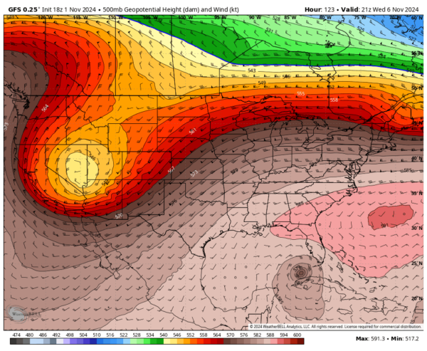
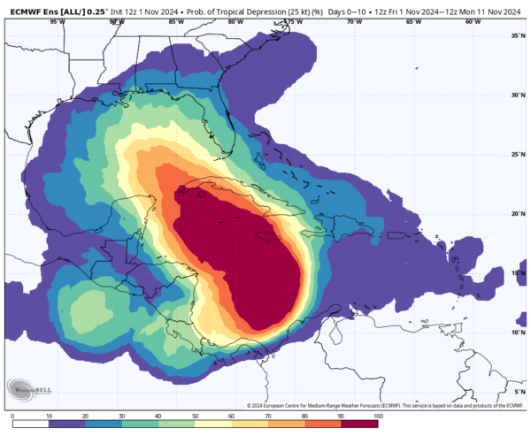
Wednesday will see the return of the ridge, drying out any lingering showers early in the day. Clouds will gradually dissipate by afternoon. We are monitoring a potential tropical system that may begin moving northwestward toward the North-Central Gulf Coast. Current models suggest we will have a clearer picture once a centralized low pressure system develops. Highs will range from the upper 70s to mid 80s.
Thursday through Friday:
As ridging strengthens over the Southeast, dry conditions will persist with mostly clear skies. Highs will remain comfortable, ranging from the mid 70s to lower 80s. By Friday, the ridge is expected to weaken as a trough from the west moves eastward. Sunny skies will continue with highs in the 70s.
Tropical Update:
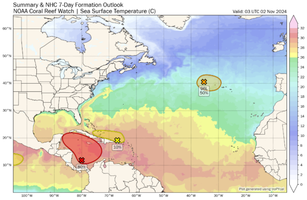
We are closely monitoring the tropics, with Invest 96L showing a 50% chance of developing into a subtropical or tropical storm in the coming days as it moves toward the Azores. This system poses no threat to the U.S. mainland. Additionally, a low near Puerto Rico could see slow development as it moves toward the Greater Antilles before being absorbed by the following potential tropical system.
A tropical depression is likely to form over the weekend or early next week in the western or central Caribbean Sea, with slow movement toward the north or northwest. The track will remain uncertain until a centralized low pressure forms, likely after it reaches the southern Gulf of Mexico.
The next two storm names are Patty and Rafael. Which system will earn these names? Stay tuned as we track their development into early next week.
Category: Alabama's Weather, ALL POSTS, Social Media, Tropical, Weather Xtreme Videos


