Midday Nowcast: Some Showers, Widespread Drought, and Tropical Mischief
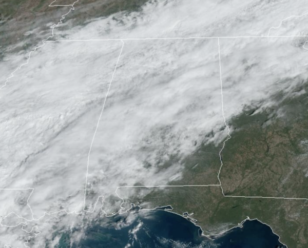
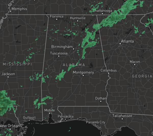
HELLO NOVEMBER: The front continues to bring clouds and some scattered showers to Alabama today, but the rain is light, and should generally dissipate later this evening. Highs today are in the 70s and low 80s.
The month of November begins to bring more active weather to Alabama, as more fronts bring rain and storms to the state. The average afternoon high for the first of the month is 70°, while the average low is 47°. By the end of the month the average high falls to 61° and the average low is 40°. The month averages 3.84” of rain, while the wettest November on record was 1948 when 15.25” of rain fell. The driest November on record was 1924 when only 0.01” of rain was recorded.
FRIDAY NIGHT LIGHTS: For the high school games tonight, most stadiums will be dry across Alabama, temperatures will be falling through the 70s, reaching the 60s by the four quarter.
BIRMINGHAM ALMANAC: For November 1st, the average high for Birmingham is 70° and the average low is 47°. The record high is 88° set in 2016, while the record low is 25° set in 19993. We average 0.13” of precipitation on this date, and the record value is 2.08” set in 1999.
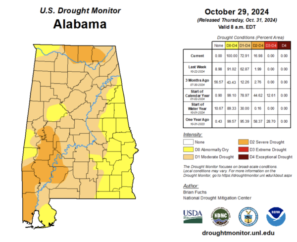
DROUGHT MONITOR: The latest drought monitor came out yesterday and in a nut shell, Alabama needs rain. All of the state is dry, while 72.91% of Alabama is suffering under moderate drought. Severe drought is impacting 16.98% of the state, and these areas are found in Tennessee Valley of the state and areas along the U.S. 43 corridor across Southwest and West Alabama stretching from Mobile County, north through Thomasville to Demopolis to near Moundville. The rain from yesterday and today are good, but will not help much. We need several steady soaking rains to help alleviate the drought. Remember drought takes time to develop, and it takes time to dissipate.
ACROSS THE USA: Warm temperatures will continue across the Eastern Seaboard Friday, where record daily high temperatures may be broken. Temperatures are expected to decrease over the weekend. A storm system is expected to bring heavy rain and high elevation snow across the Pacific Northwest and into far northern California through Friday night.
WEEKEND AND BEYOND: The weekend will be dry with warm afternoons and pleasant nights; highs will stay in the low 80s, with lows in the low to mid 60s. These temperatures are well-above average for early November, ranging 10-15 degrees above average. Not much change in the forecast for next week, and most of the week looks to remain dry with highs in the low 80s and low 60s. We will mention moisture levels begin to rise late in the week, and we will at least mention the chance of some showers returning to Alabama.
FOOTBALL WEATHER: Tomorrow, Auburn hosts Vanderbilt at Jordan-hare Stadium (11:45a CT kickoff)… expect a good supply of sunshine with temperatures rising from near 78 at kickoff into the low 80s by the second half.
UAB will host Tulsa at Protective Stadium in downtown Birmingham (1:30p CT kickoff)… the sky will be mostly sunny with temperatures hovering around 80 degrees during the game.
Troy will host Coastal Carolina (3:00p CT kickoff); it will be a sunny Saturday with temperatures falling from near 82 at kickoff into the 70s by the fourth quarter.
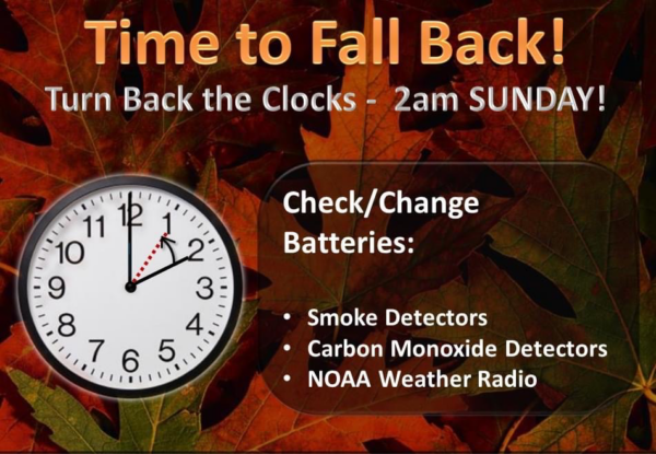
FALL BACK: Daylight Saving Time ends tomorrow night as we fall back onto Standard Time meaning we turn the clocks back one hour. Sunrise for Birmingham tomorrow will be at 7:07AM while sunset is at 5:53PM. But on Sunday, sunrise will be at 6:08AM and sunset will be at 4:52PM. This is a good reminder to also check your batteries in smoke and carbon monoxide detectors as well as your NOAA Weather Radios.
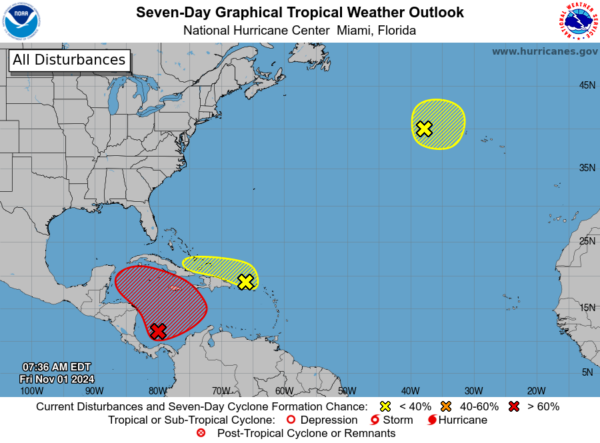
IN THE TROPICS: Three areas the NHC is monitoring as we start the final month of the season. In the Southwestern Caribbean Sea, a broad area of low pressure is likely to develop over the southwestern Caribbean Sea during the next day or so. Gradual development is possible thereafter, and a tropical depression is likely to form late this weekend or early next week while the system drifts generally northward or northwestward over the central or western Caribbean Sea. Regardless of development, locally heavy rains are possible over portions of the adjacent land areas of the western Caribbean. Formation chance through 48 hours…low…30 percent. Formation chance through 7 days…high…70 percent.
Next, in the Northeastern Caribbean Sea and Greater Antilles, a trough of low pressure located near Puerto Rico is producing a large area of showers and thunderstorms over portions of the Greater Antilles and the adjacent waters of the Atlantic and the northeastern Caribbean. Slow development of this system is possible during the next few days as it moves west-northwestward near the Greater Antilles. After that time, this system is expected to be absorbed into the low pressure area over the Caribbean. Regardless of development, locally heavy rains are possible during the next several days from the northern Leeward Islands westward across Puerto Rico and Hispaniola to eastern Cuba and the southeastern Bahamas. Formation chance through 7 days…low…10 percent.
Finally, in the North Atlantic, a storm-force non-tropical low pressure area located about 400 miles west of the western Azores is producing limited shower activity. Some subtropical development is possible while the low moves generally eastward during the next few days. Formation chance through 7 days…low…10 percent.
Next name up are Patty, Rafael, and Sara.
WORLD TEMPERATURE EXTREMES: Over the last 24 hours, the highest observation outside the U.S. was 112.5F at Marble Bar, Australia. The lowest observation was -72.9F at Dome A, Antarctica.
CONTIGUOUS TEMPERATURE EXTREMES: Over the last 24 hours, the highest observation was 96F at La Puerta, TX. The lowest observation was -9F at Peter Sinks, UT.
Category: Alabama's Weather, ALL POSTS, Social Media


