Midday Nowcast: Phenomenal Fall Weather
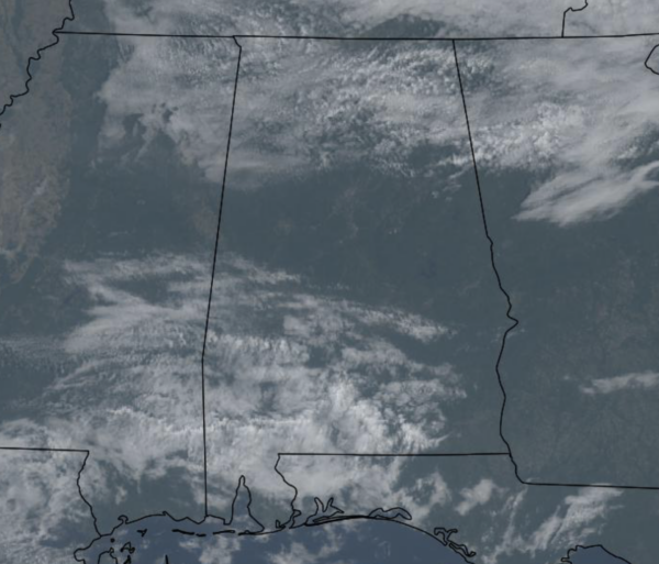
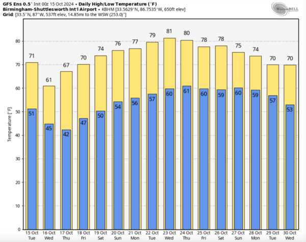
Today and the rest of the week, expect sunny, very pleasant days, and clear, cold nights. Highs are in the 70s today, but will drop into the 60s tomorrow and Thursday, but should return to the 70s Friday. Our coldest mornings this week will come early tomorrow and Thursday when much of North Alabama will dip into the 30s for the first time this season. Frost advisories are likely going to be needed for some portions of the state. These highs and lows will are a good 10-15 degrees below average for mid-October in Alabama.
BIRMINGHAM ALMANAC: For October 15th, the average high for Birmingham is 76° and the average low is 54°. The record high is 90° set in 1897, while the record low is 34° set in 1978. We average 0.10” of precipitation on this date, and the record value is 1.92” set in 1932.
WEEKEND AND BEYOND: Dry weather continues; expect sunshine in full supply Saturday and Sunday with highs in the 70s. And, the long dry spell continues through next week and temperatures moderate some with highs closer to 80 degrees. Statistically, October is the driest month of the year for Alabama and much of the Deep South, so little to no rain in Alabama this time of year is completely normal.
IN THE TROPICS: In the Central Tropical Atlantic, Invest 94L is an area of low pressure located over the central tropical Atlantic is producing disorganized showers and thunderstorms. This system is forecast to move generally westward, and environmental conditions could become more conducive for gradual development by the middle to latter part of this week. A tropical depression could form as the system begins moving west-northwestward and approaches or moves near the Leeward Islands late this week. Formation chance through 48 hours…low…30 percent. Formation chance through 7 days…medium…60 percent.
It is still too early to know if this moves into the Gulf of Mexico or impacts any part of the U.S. coastline. Simply something to watch for now.
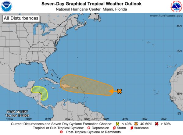
Also, in the western Caribbean, a broad area of low pressure could develop over the southwestern Caribbean Sea by the middle to latter portions of this week. Some gradual development is possible thereafter if the system stays over water while it moves slowly west-northwestward towards northern Central America. Regardless of development, locally heavy rainfall is possible across portions of Central America later this week. Formation chance through 7 days…low…30 percent.
The next names up are Nadine and Oscar.
WORLD TEMPERATURE EXTREMES: Over the last 24 hours, the highest observation outside the U.S. was 108.7F at Mina, Saudi Arabia. The lowest observation was -81.2F at Dome A, Antarctica.
CONTIGUOUS TEMPERATURE EXTREMES: Over the last 24 hours, the highest observation was 103F at Phoenix, AZ. The lowest observation was 17F at Peter Sinks, UT.
Category: Alabama's Weather, ALL POSTS, Social Media
About the Author (Author Profile)
Macon, Georgia Television Chief Meteorologist, Birmingham native, and long time Contributor on AlabamaWX. Stormchaser. I did not choose Weather, it chose Me. College Football Fanatic. @Ryan_StinnetSubscribe
If you enjoyed this article, subscribe to receive more just like it.


