
Frost Likely For North Alabama Early Wednesday/Thursday Morning
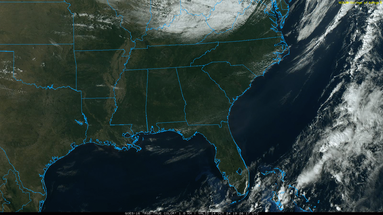
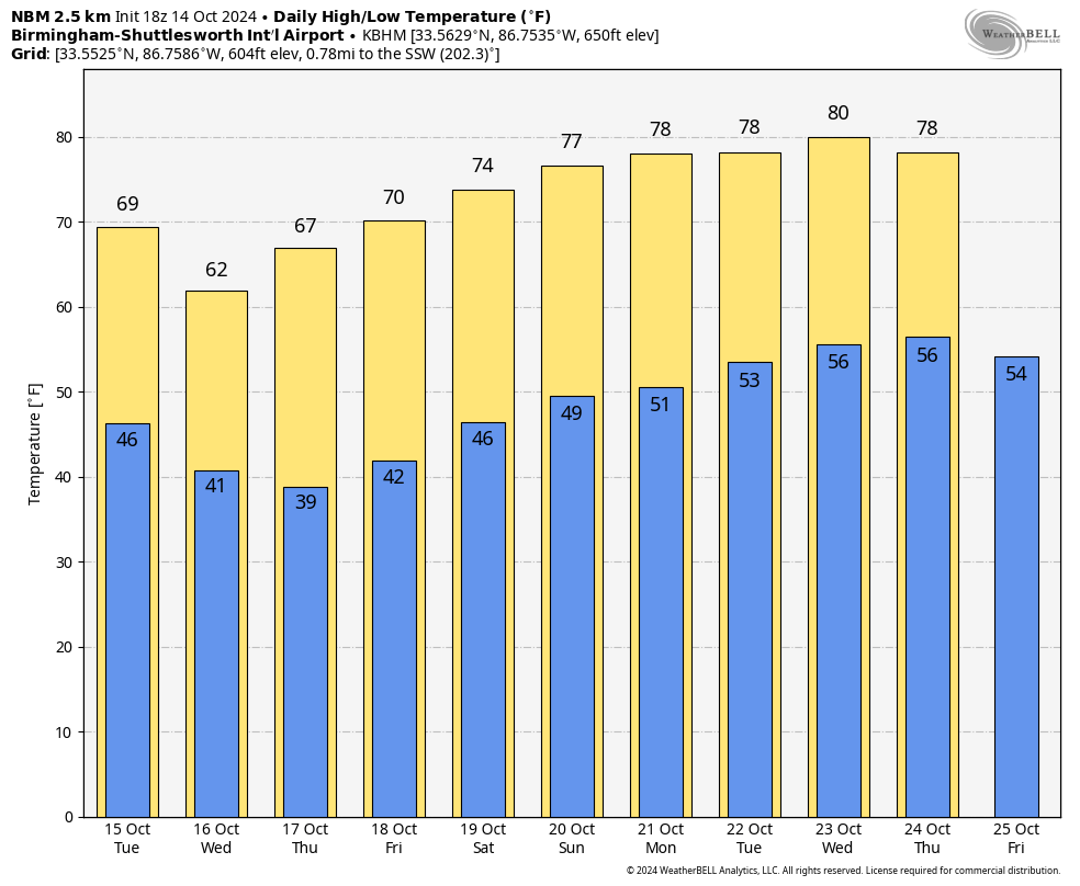
COOL BREEZE: Cooler air continues to roll into Alabama and the Deep South this afternoon. Temperatures are in the 60s and 70s over the northern half of the state, with 80s to the south. Tonight will be clear and cool with a low in the 40s and 50s.
Our coldest mornings this week will come early Wednesday and Thursday when much of North Alabama will dip into the 30s for the first time this season. Frost advisories will be needed, and some of the colder pockets could be close to freezing. Highs will be in the 60s for much of the state Wednesday and Thursday, about 10-15 degrees below average. Dry air means sunny days and clear nights through the week.
THE ALABAMA WEEKEND: Dry weather continues; expect sunshine in full supply Saturday and Sunday with highs in the 70s. And, the long dry spell continues through next week.
Most of Alabama has not seen a drop of rain for the entire month of October; the last measurable rain at Birmingham was on September 28, and the total that day was only 0.01″. The last significant rain was on September 25, when the total was 0.61″. Could we go through the entire month of October with no rain?
Understand this is the driest month of the year based on climatology, and it has happened before. Birmingham had no rain at all in October 1924, and just a trace in October 2016.
The month of October brought less than a quarter of an inch in these years…
1938 0.05″
1991 0.07″
1963 0.11″
1939 0.17″
1953 0.21″
1978 0.22″
1901 0.23″
1904 0.24″
Keep in mind our tornado season begins in November (it runs from November throw May), so we usually see frequent big rain events increasing then.
See the video briefing for maps, graphics, and more details.
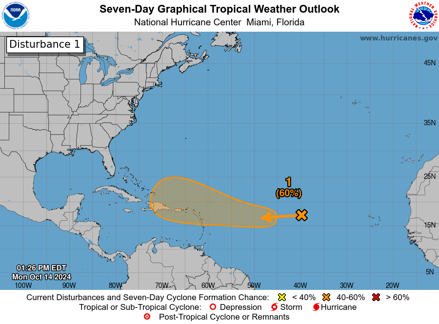
TROPICS: A well-defined area of low pressure (Invest 94L) located roughly midway between the Cabo Verde Islands and the Lesser Antilles is producing limited shower and thunderstorm activity. This system is currently embedded in a dry air environment, and development is unlikely over the next couple of days. However, this system is forecast to move generally westward toward warmer waters, and environmental conditions could become more favorable for gradual development by the middle to latter part of this week. A tropical depression could form as the system begins moving west-northwestward and approaches or moves near the Leeward Islands late this week.
NHC gives it a 60 percent chance of developing over the next seven days, and it is simply too early to know if this will get into the Gulf of Mexico, or impact any part of the U.S. coast.
ON THIS DATE IN 1909: An F3 tornado struck Pittsburg Landing and Stantonville, TN killing 23 people and injuring 80 others.
Look for the next video briefing here by 6:00 a.m. tomorrow…
Category: Alabama's Weather, ALL POSTS, Weather Xtreme Videos
About the Author (Author Profile)
James Spann is one of the most recognized and trusted television meteorologists in the industry. He holds the AMS CCM designation and television seals from the AMS and NWA. He is a past winner of the Broadcast Meteorologist of the Year from both professional organizations.Subscribe
If you enjoyed this article, subscribe to receive more just like it.


