
A Look at the Tropics on this Monday!
It is officially hurricane season through November 30, so we are constantly on the lookout for anything that looks suspicious.
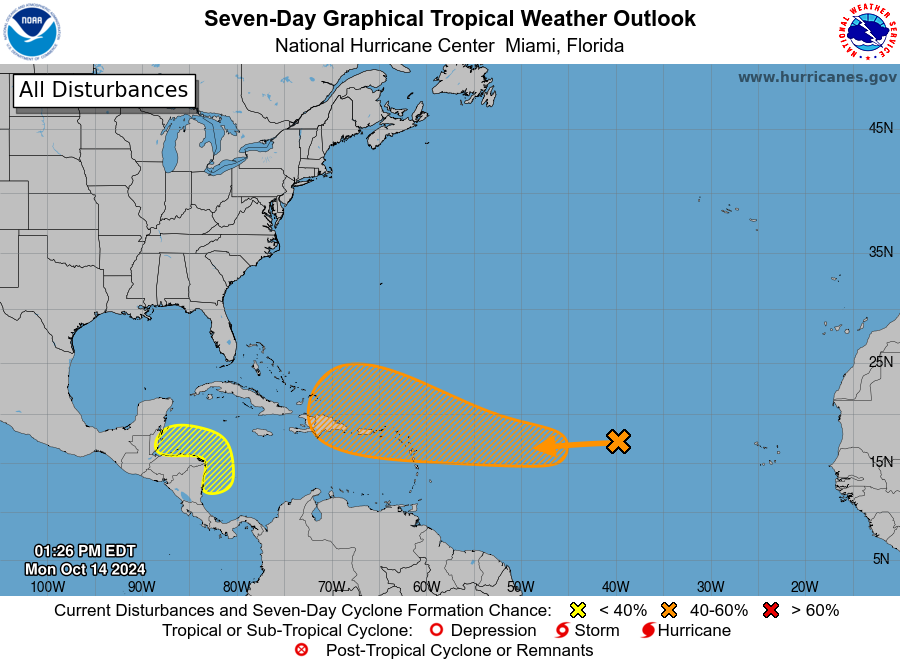
The NHC has highlighted two areas of interest. The area in orange over the central Tropical Atlantic (also known as Invest 94L), has a 60% chance of formation over the next 7 days. This well-defined area of low pressure is between the Cabo Verde Islands and the Lesser Antilles. It is in the midst of some very dry air right now and immediately development not expected. As it moves further west though, conditions become a bit more conducive for formation. The NHC states a tropical depression could form as this low moves closer to the Leeward Islands.
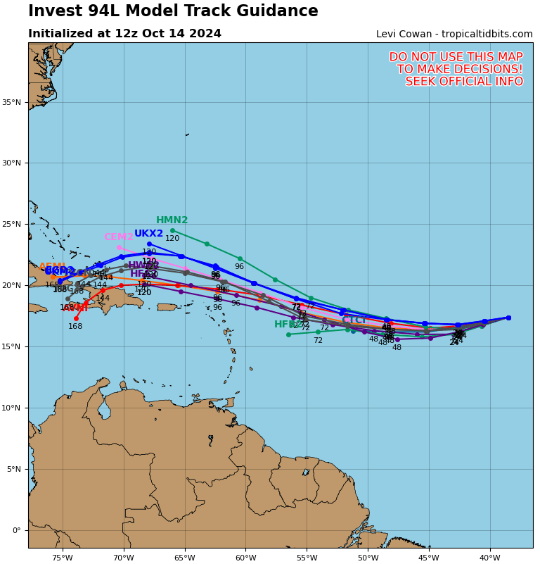
Here are the 12z tracks from the GFS+Hurricane models from the Tropical Tidbits site. Certainly bares watching.
The other area of interest is down in the western Caribbean. A broad area of low pressure here could form by mid to late week. It is projected to slowly move WNW toward northern Central America. It could developed if it stay over the water long enough. Formation chance through 7 day: 20%
Category: ALL POSTS, Social Media, Tropical
About the Author (Author Profile)
Owner of Tornado Talk. Radio broadcast meteorologist with The Storm Report. WeatherBrains Panelist. B.S. Meteorology from Penn State University.Subscribe
If you enjoyed this article, subscribe to receive more just like it.


