
Midday Nowcast: Dry Cold Front Bringing Much Cooler Air to Alabama
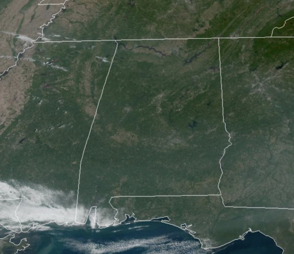
DRY COLD FRONT: Another front is moving through Alabama today with no clouds and no rain, but it will bring noticeable cooler weather to Alabama today and the rest of this week. We have brisk north wind today, and our afternoon highs are in the 70s. For the rest of the week, expect sunny, very pleasant days, and clear, cold nights. Highs will drop into the 60s on Wednesday, and will remain there through Friday. Our coldest mornings this week will come early Wednesday and Thursday when much of North Alabama will dip into the 30s for the first time this season. Frost advisories will be needed, and some of the colder pockets could be close to freezing. These highs and lows will are a good 10-15 degrees below average for mid-October in Alabama.
BIRMINGHAM ALMANAC: For October 14th, the average high for Birmingham is 77° and the average low is 55°. The record high is 89° set in 1984, while the record low is 36° set in 1988. We average 0.11” of precipitation on this date, and the record value is 1.45” set in 1972.
THE ALABAMA WEEKEND: Dry weather continues; expect sunshine in full supply Saturday and Sunday with highs in the 70s. And, the long dry spell continues through next week. Understand this is the driest month of the year based on climatology, so little to no rain in Alabama this time of year is completely normal.
IN THE TROPICS: In the Central Tropical Atlantic, Invest 94L is a well-defined area of low pressure located several hundred miles west of the Cabo Verde Islands is producing some disorganized showers and thunderstorms. This system is currently embedded in a dry environment, and development is unlikely over the next couple of days. However, this system is forecast to move generally westward toward warmer waters, and environmental conditions could become more favorable for gradual development by the middle to latter part of this week. A tropical depression could form as the system begins moving west-northwestward and approaches or moves near the Leeward Islands late this week. Formation chance through 7 days…medium…50 percent.
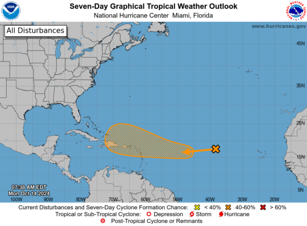
A tropical depression could form as the system begins moving west-northwestward and approaches or moves near the Leeward Islands by the end of this week, and it is simply too early to know if this will get into the Gulf of Mexico, or impact any part of the U.S. coast. The next name up is Nadine.
WORLD TEMPERATURE EXTREMES: Over the last 24 hours, the highest observation outside the U.S. was 111.0F at Augrabies Falls, South Africa. The lowest observation was -81.4F at Dome A, Antarctica.
CONTIGUOUS TEMPERATURE EXTREMES: Over the last 24 hours, the highest observation was 105F at Mohawk, AZ. The lowest observation was 18F at Peter Sinks, UT.
Category: Alabama's Weather, ALL POSTS, Social Media
About the Author (Author Profile)
Macon, Georgia Television Chief Meteorologist, Birmingham native, and long time Contributor on AlabamaWX. Stormchaser. I did not choose Weather, it chose Me. College Football Fanatic. @Ryan_StinnetSubscribe
If you enjoyed this article, subscribe to receive more just like it.


