
Summer’s Last Stand This Weekend; The Big Cool Down Starts on Monday
After a cool start this morning, high pressure sitting over the southeast will allow for our afternoon temperatures to warm up rather quickly. Skies will be sunny with highs reaching the lower to mid 80s across the area.
For Alabama’s home game against South Carolina at Bryant-Denny Stadium, kickoff temperatures will be around 77°F under sunny skies, climbing into the low 80s by the end of the game.
Meanwhile, UAB is on the road at Army in West Point, NY. The weather will be dry with plenty of sunshine. Kickoff will start around 68°F, and temperatures will rise to the low 70s by the fourth quarter. Perfect football weather!
On Sunday, we’ll have a cold front heading in our direction that will allow for some warmer air to creep into the state. We will continue to stay dry with mainly sunny skies. Highs will top out in the mid to upper 80s.
The cold front will move through the area on Monday, and a few sprinkles may be possible during the early morning hours before sunrise. Once the front passes through, get ready for a reinforcing shot of dry air and cooler temperatures. Highs will top out in the upper 60s in the north to the lower 80s in the south.
Fall has truly arrived as you will see starting on Tuesday. Ridging will start to build to our west which will start a northwesterly flow across Alabama. We’ll have a cool start to the day, and afternoon highs will only top out in the mid 60s to the lower 70s.
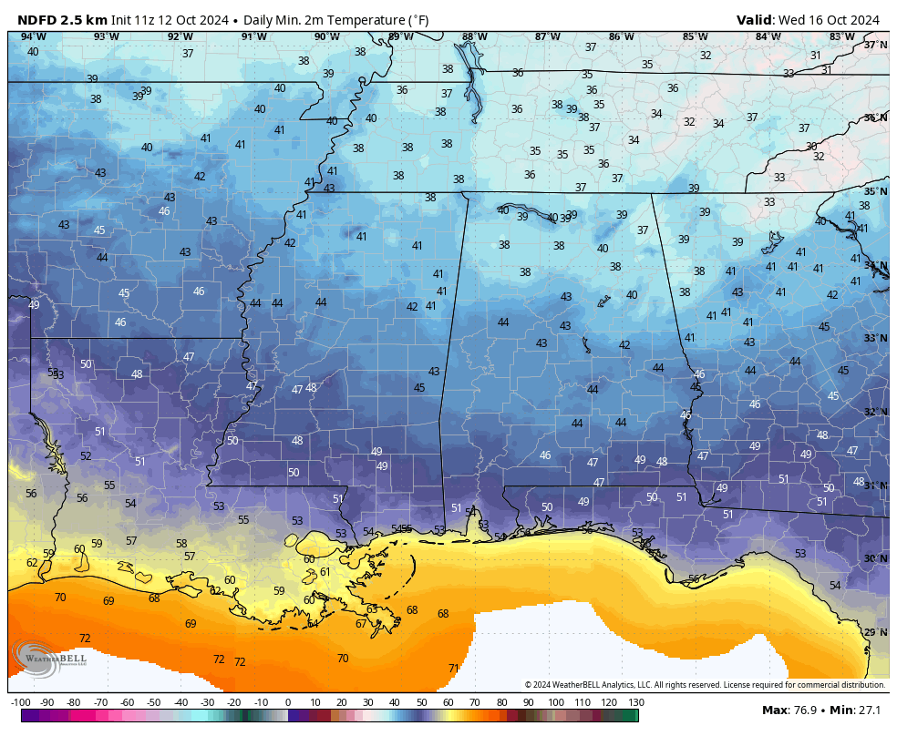
There is the potential for frost advisories to be issued on Wednesday morning as early morning lows will bottom out in the upper 30s to the mid 40s. After that, we’ll have sunny skies with highs in the mid to upper 60s.
Much of the same story on Thursday, as we’ll start off chilly. We’ll have plenty of sunshine, and we’ll warm up nicely during the day, as highs will reach the upper 60s to the lower 70s.
And at the end of the forecast period on Friday, the ridging will be centered just off to our north. That will allow for sunny skies with slightly warmer temperatures. Highs in the lower to mid 70s.
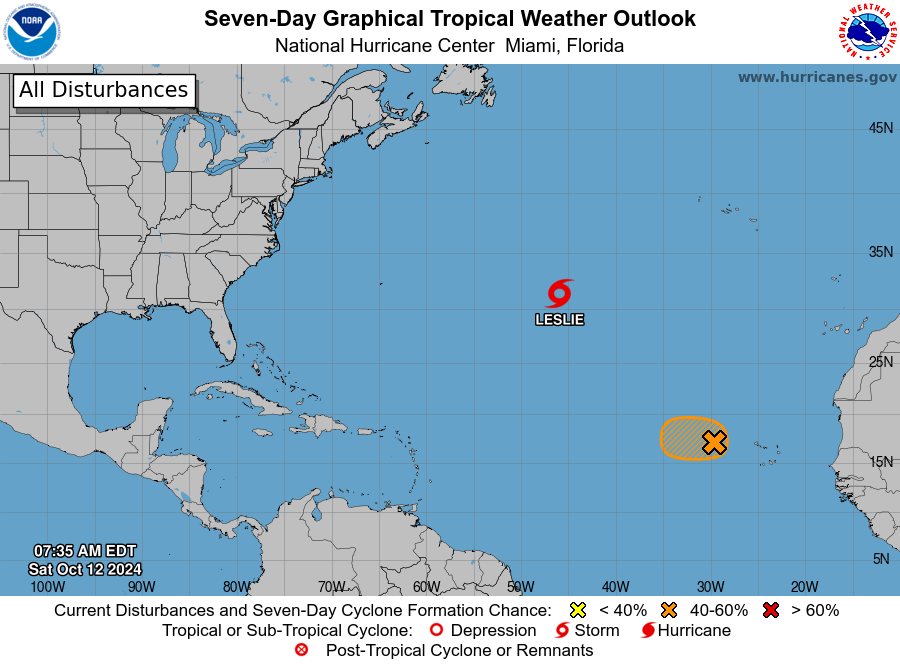
Tropical Storm Leslie is racing off to the northeast and will transition into an extratropical cyclone later tonight or early on Sunday. At this point, her winds were topping out around 50 mph.
We also have Invest 94L out there west of the Cabo Verde Islands that may briefly become a depression or tropical storm later today. However, conditions will become rough on the system, and it is not expected to last long at all.
The rest of the tropics are quiet for now.
Category: Alabama's Weather, ALL POSTS, Social Media, Tropical, Weather Xtreme Videos
About the Author (Author Profile)
Scott Martin is an operational meteorologist, professional graphic artist, musician, husband, and father. Not only is Scott a member of the National Weather Association, but he is also the Central Alabama Chapter of the NWA president. Scott is also the co-founder of Racecast Weather, which provides forecasts for many racing series across the USA. He also supplies forecasts for the BassMaster Elite Series events including the BassMaster Classic.Subscribe
If you enjoyed this article, subscribe to receive more just like it.


