
Sunny Warm Days, Clear Cool Nights
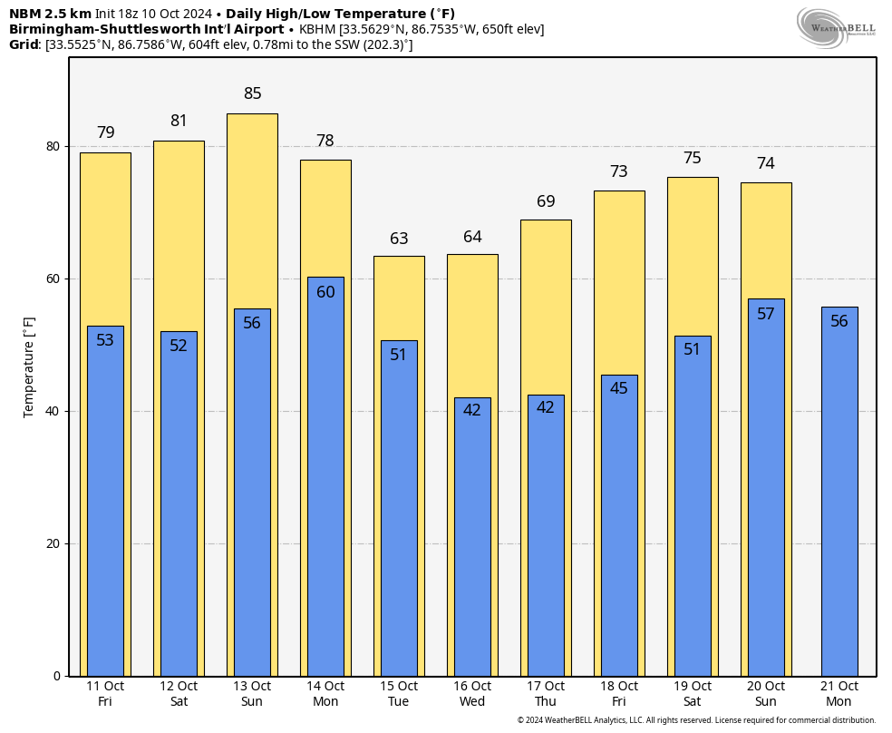
SEVERE CLEAR: Not a cloud in the sky across Alabama this afternoon; temperatures are in the 70s over North Alabama, with low 80s to the south. Tonight will be clear and cool with a low in the 47-54 degree range for most places.
Dry weather continues tomorrow through Sunday with sunny warm days and clear cool nights. The coolest morning will come early Saturday, when some spots over North Alabama will drop into the 40s. Sunday feature the warmest afternoon with a high in the mid 80s.
NEXT WEEK: A cold front will pass through the state on Monday, but with very little moisture we just don’t expect any meaningful rain. The coolest air so far this season arrives by mid-week with highs in the 60s and lows in the 40s for most places; colder pockets over the northern third of the state will likely see upper 30s by Wednesday morning.
And, global models continue to suggest the dry weather will persist for the next 10 days… See the video briefing for maps, graphics, and more details.
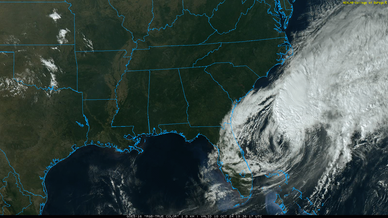
TROPICS: Milton is now post-tropical in the Atlantic, and will continue to move away from the U.S. Elsewhere, Hurricane Leslie is in the middle of the Atlantic with winds of 90 mph. It will weaken and turn northeast today; it is no threat to land.
A tropical wave is in the eastern Atlantic, but it has only a 20 percent chance of developing. The rest of the Atlantic basin is quiet.
FOOTBALL WEATHER: Expect a clear sky for the high school games across Alabama tomorrow night with temperatures falling from the low 70s at kickoff, into the 60s during the second half.
Saturday, Alabama hosts South Carolina (11:00a CT kickoff) at Bryant-Denny Stadium… the sky will be sunny with temperatures rising from near 77 at kickoff, into the low 80s by the final whistle.
UAB is on the road; they play Army in West Point NY (11:00a CT kickoff)… the weather will be dry. With a sunny sky, temperatures rise from 68 degrees at kickoff into the low 70s by the fourth quarter.
ON THIS DATE IN 2018: Destructive Hurricane Michael made landfall near Mexico Beach with winds of 160 mph. It became the first Category 5 hurricane to make landfall in the contiguous United States since Andrew in 1992. It was the third-most intense Atlantic hurricane to make landfall in the contiguous United States in terms of pressure, behind the 1935 Labor Day hurricane and Hurricane Camille in 1969. Michael was the first Category 5 hurricane on record to impact the Florida Panhandle, the fourth-strongest landfalling hurricane in the contiguous United States, in terms of wind speed, and the most intense hurricane on record to strike the United States in the month of October.
At least 74 deaths were attributed to the storm, including 59 in the United States and 15 in Central America. Michael caused an estimated $25.1 billion in damage. Along the Florida panhandle, the cities of Mexico Beach and Panama City suffered the worst of Michael, incurring catastrophic damage from the extreme winds and storm surge. Numerous homes were flattened and trees felled over a wide swath of the panhandle. A maximum wind gust of 139 mph was measured at Tyndall Air Force Base before the sensors failed. Peak storm surge inundation was 9-14 feet from Mexico Beach to Indian Pass.
Look for the next video briefing here by 6:00 a.m. tomorrow…
Category: Alabama's Weather, ALL POSTS, Weather Xtreme Videos
About the Author (Author Profile)
James Spann is one of the most recognized and trusted television meteorologists in the industry. He holds the AMS CCM designation and television seals from the AMS and NWA. He is a past winner of the Broadcast Meteorologist of the Year from both professional organizations.Subscribe
If you enjoyed this article, subscribe to receive more just like it.


