
10PM CDT Milton Update: Still a Strong Category 2 Hurricane; Set to Move Across Florida Tonight
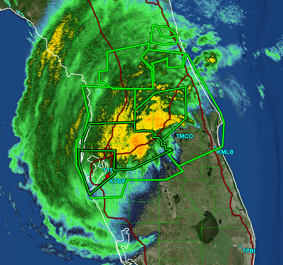
Hurricane Milton is now fully inland, and has retained its strong category 2 status. This is a very dangerous situation for Central Florida, and all residents should take shelter until the storm passes. Milton will continue to move to the northeast overnight, and will move off into the Atlantic tomorrow.
Hurricane force winds are extending up to 35 miles away from the center of the storm, and tropical storm force winds are extending up to 255 miles away.
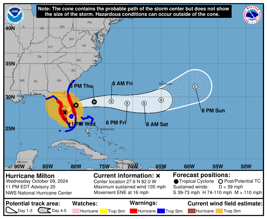
Here are the latest stats from the NHC:
SUMMARY OF 1100 PM EDT…0300 UTC…INFORMATION
———————————————–
LOCATION…27.6N 82.0W
ABOUT 75 MI…120 KM SW OF ORLANDO FLORIDA
ABOUT 100 MI…165 KM WSW OF CAPE CANAVERAL FLORIDA
MAXIMUM SUSTAINED WINDS…105 MPH…165 KM/H
PRESENT MOVEMENT…ENE OR 60 DEGREES AT 16 MPH…26 KM/H
MINIMUM CENTRAL PRESSURE…960 MB…28.35 INCHES
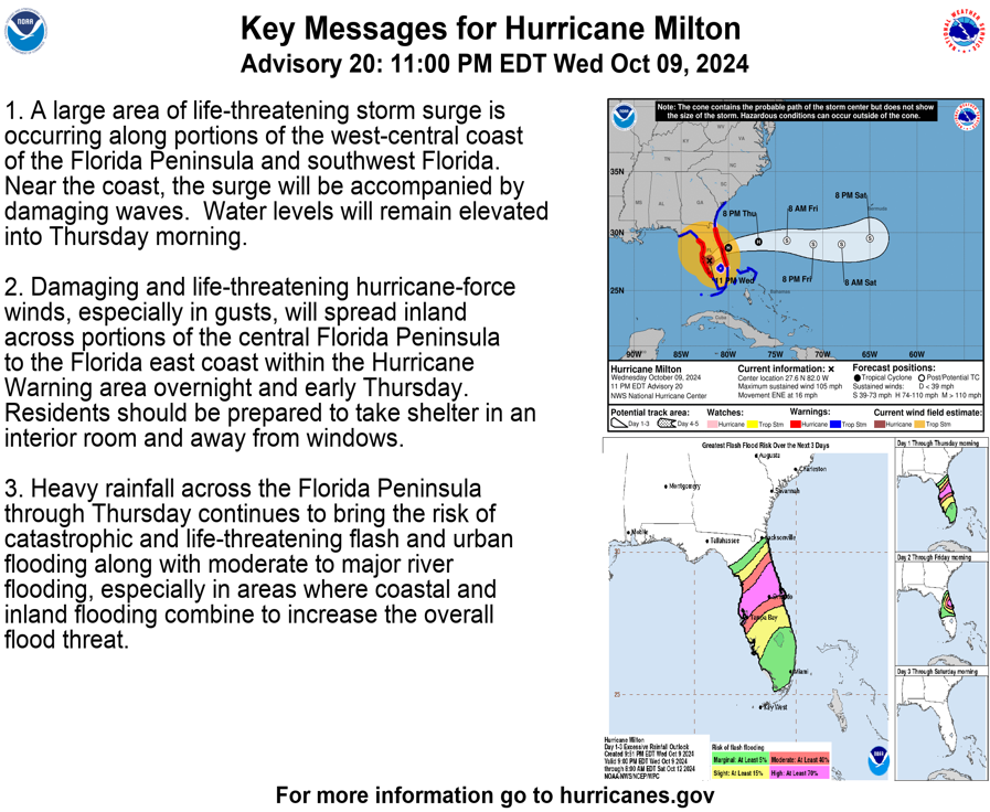
SUMMARY OF WATCHES AND WARNINGS IN EFFECT:
A Storm Surge Warning is in effect for…
* Florida west coast from Flamingo northward to Anclote River,
including Charlotte Harbor and Tampa Bay
* Sebastian Inlet Florida to Altamaha Sound Georgia, including the
St. Johns River
A Hurricane Warning is in effect for…
* Florida west coast from Bonita Beach northward to Suwannee River,
including Tampa Bay
* Florida east coast from the St. Lucie/Martin County Line northward
to Ponte Vedra Beach
A Hurricane Watch is in effect for…
* Lake Okeechobee
* Florida east coast from the St. Lucie/Martin County Line to the
Palm Beach/Martin County Line
A Tropical Storm Warning is in effect for…
* Florida Keys, including Dry Tortugas and Florida Bay
* Lake Okeechobee
* Florida west coast from Flamingo to south of Bonita Beach
* Florida west coast from north of Suwanee River to Indian Pass
* Florida east coast south of the St. Lucie/Martin County Line to
Flamingo
* North of Ponte Vedra Beach Florida to Edisto Beach South Carolina
* Extreme northwestern Bahamas, including Grand Bahama Island, the
Abacos, and Bimini
Milton officially made landfall at 7:30PM CDT just south of Tampa. There have been several reports of wind damage around the Tampa Bay area, as well as extreme rainfall rates. One such report included a measurement of 5.09 inches of rain in just one hour at St. Petersburg, FL.
Currently, there is a large area of storm surge occurring along the western coast of Central Florida. Large waves are rushing ashore, and water levels will remain elevated through tomorrow.
Those in Central Florida should plan to shelter for most of the night tonight. Winds will continue to be extremely strong and damaging, even miles inland. This will be true for as long as Milton is over the Florida Peninsula.
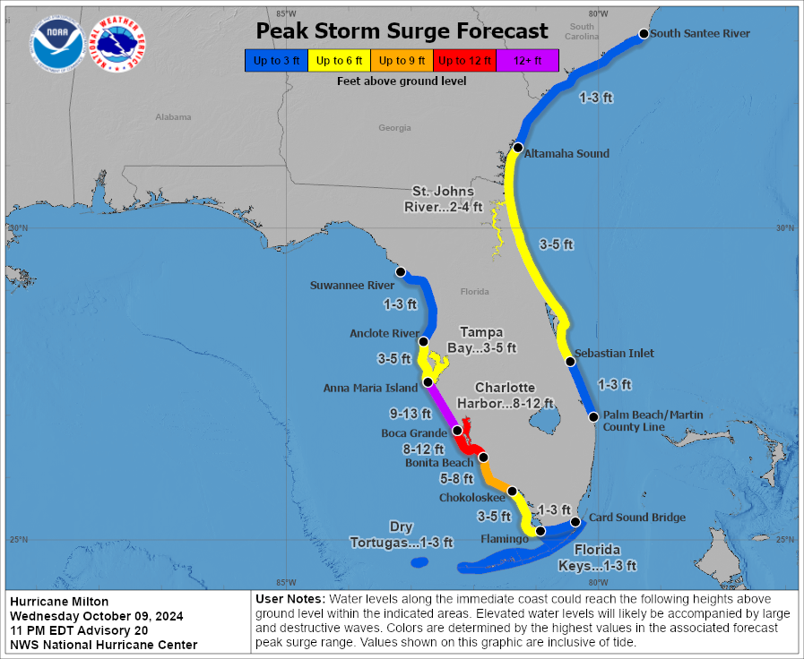
Here are the updated storm surge forecast amounts:
Not including rain that has already fallen, here are the forecasted additional rain totals for the rest of the night through Friday:
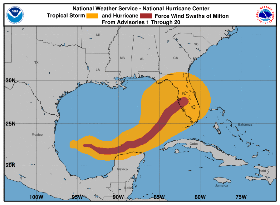
The following graphic is a historical view of Milton’s track as it moved across the Gulf, with hurricane and tropical storm force wind fields highlighted:
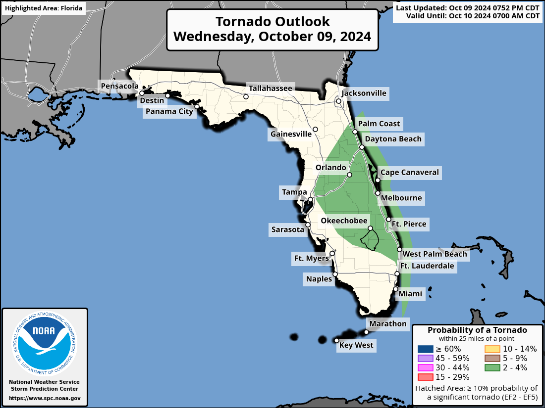
The tornado threat for Central Florida continues tonight, although the chances of a tornado have decreased slightly. Here is a graphic outlining the risk areas:
Stay tuned as we will recap Hurricane Milton starting tomorrow.
Category: ALL POSTS, Social Media, Tropical
About the Author (Author Profile)
Scott is a senior at Mississippi State University studying professional and broadcast meteorology.Subscribe
If you enjoyed this article, subscribe to receive more just like it.


