
6PM CDT Milton Update: Northern Eyewall Closely Nearing the Florida Coastline
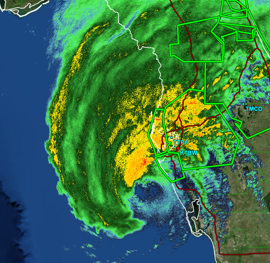
Milton’s northern eyewall is beginning to move onshore in just south of the Tampa Bay area. Hurricane force winds are actively spreading across the area, and this is an extremely dangerous situation. Here is current radar imagery of Milton:
Here is the latest messaging from the NHC:
Hurricane Milton Tropical Cyclone Update
NWS National Hurricane Center Miami FL AL142024
700 PM EDT Wed Oct 09 2024
…NORTHERN EYEWALL OF MILTON STARTING TO SPREAD ONSHORE ALONG
THE FLORIDA GULF COAST…
…700 PM EDT POSITION UPDATE…
The northern eyewall of Hurricane Milton is beginning to move
onshore of the Florida gulf coast near Tampa and St. Petersburg
where an Extreme Wind Warning is now in effect. Please shelter in
place as these extremely dangerous hurricane-force winds overspread
the region.
A sustained wind of 61 mph (98 km/h) and a gust of 77 mph (124 km/h)
was recently reported at a WeatherFlow station at Egmont Channel. A
sustained wind of 44 mph (71 km/h) and a gust of 77 mph (124 km/h)
was recently reported at the Sarasota-Bradenton International
Airport. A sustained wind of 55 mph (89 km/h) and a gust of 71 mph
(114 km/h) was recently reported at a WeatherFlow station at Skyway
Fishing Pier.
The next update will be the intermediate advisory at 800 PM EDT
(0000 UTC).
SUMMARY OF 700 PM EDT…2300 UTC…INFORMATION
———————————————–
LOCATION…27.1N 83.0W
ABOUT 35 MI…50 KM WSW OF SARASOTA FLORIDA
ABOUT 140 MI…225 KM SW OF ORLANDO FLORIDA
MAXIMUM SUSTAINED WINDS…120 MPH…205 KM/H
PRESENT MOVEMENT…NE OR 55 DEGREES AT 15 MPH…24 KM/H
MINIMUM CENTRAL PRESSURE…952 MB…28.11 INCHES
Category: ALL POSTS, Social Media, Tropical
About the Author (Author Profile)
Scott is a senior at Mississippi State University studying professional and broadcast meteorology.Subscribe
If you enjoyed this article, subscribe to receive more just like it.


