
Alabama’s Long Dry Spell To Continue; Milton Makes Landfall Tonight
SUNNY DAY: Temperatures are mostly in the low to mid 80s across Alabama this afternoon with a sunny sky. Tonight will be fair and pleasant with lows in the 50s over the northern counties, and 60s to the south.
Still no sign of any meaningful rain for Alabama for the next seven to ten days. Expect sunny warm afternoons and clear cool nights through the weekend with highs mostly in the upper 70s and low 80s, although the southern third of the state will see mid 80s. Morning lows will be in the 50s over North Alabama, with 60s to the south.
Another dry cold front will move through the state Monday, and that will bring the coolest air so far this season in about a week. Highs drop into the 60s, with lows in the 40s. Some of the colder spots across North Alabama will be in the upper 30s for the first time this season. See the video briefing for maps, graphics, and more details.
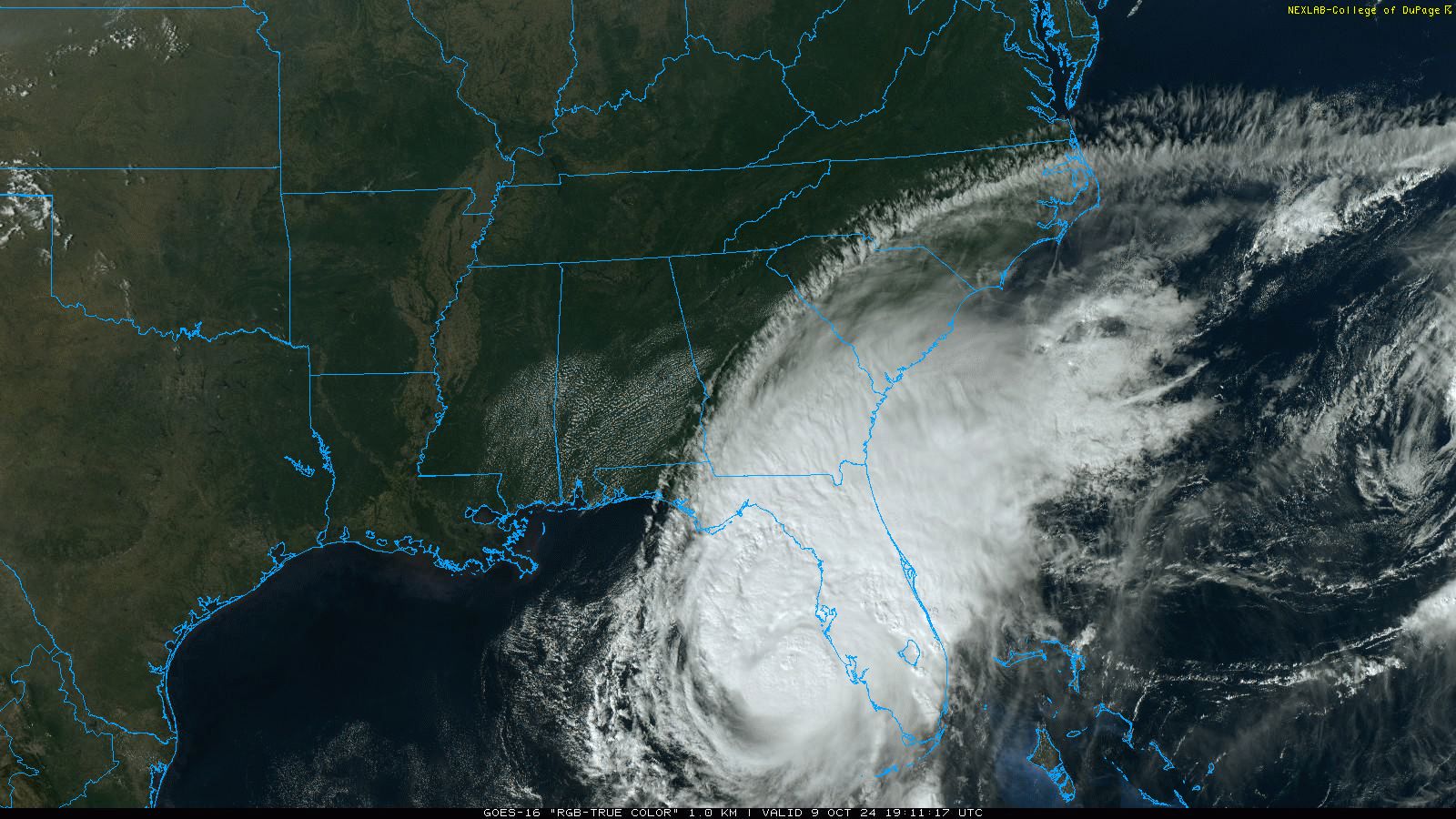
TROPICS: Milton is growing in size this afternoon; sustained winds are 125 mph. The hurricane is about 150 miles southwest of Tampa, and is moving to the northeast at 17 mph. Landfall tonight just south of Tampa Bay… Milton has the potential to be one of the most destructive hurricanes on record for West-Central Florida. A storm surge of 9-13 feet is forecast along and south of where the circulation center makes landfall (generally south of Tampa Bay).
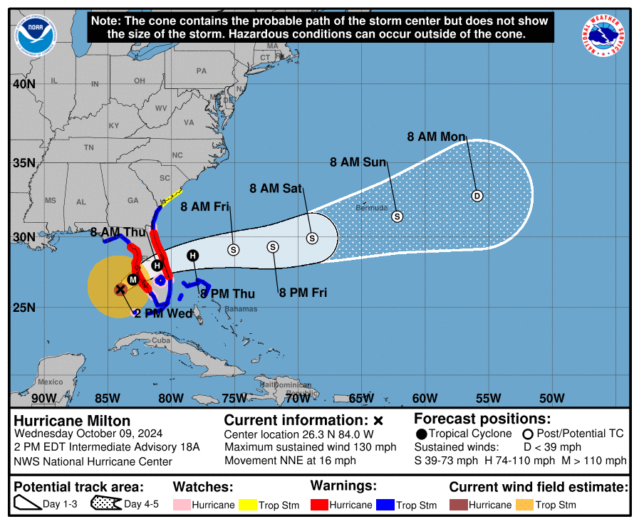
The system will likely maintain hurricane strength as it moves across the Florida Peninsula tomorrow morning; hurricane force winds are likely at Orlando, Melbourne, and Daytona Beach. This is a very high impact, life threatening hurricane; Long duration power outages are likely.
Elsewhere, Hurricane Leslie is in the middle of the Atlantic with winds of 85 mph, it turns north tonight and is no threat to land. Also, Showers and thunderstorms associated with a gale-force non-tropical low pressure system located less than 300 miles west-southwest of Bermuda remain disorganized. Environmental conditions are becoming less favorable for tropical or subtropical development today while the low moves northeastward to east-northeastward at around 15 mph. Upper-level winds are expected to become too strong for further development tonight or on Thursday. NHC gives this a 30 percent chance of short term development.
FOOTBALL WEATHER: Tonight Jacksonville State hosts New Mexico State (6:30p CT kickoff)… the sky will be clear with temperatures falling through the 70s.
Expect a clear sky for the high school games across Alabama Friday night with temperatures falling from the low 70s at kickoff, into the 60s during the second half.
Saturday, Alabama hosts South Carolina (11:00a CT kickoff) at Bryant-Denny Stadium… the sky will be sunny with temperatures rising from near 77 at kickoff, into the low 80s by the final whistle.
UAB is on the road; they play Army in West Point NY (11:00a CT kickoff)… the weather will be dry. With a sunny sky, temperatures rise from 68 degrees at kickoff into the low 70s by the fourth quarter.
ON THIS DATE IN 2001: An unusually strong fall outbreak of tornadoes spawned at least 23 twisters across parts of Nebraska and Oklahoma. Hardest hit was the town of Cordell, OK, but a 22 minute lead time led to an amazingly low casualty count: only nine injuries and no fatalities.
Look for the next video briefing here by 6:00 a.m. tomorrow…
Category: Alabama's Weather, ALL POSTS, Weather Xtreme Videos
About the Author (Author Profile)
James Spann is one of the most recognized and trusted television meteorologists in the industry. He holds the AMS CCM designation and television seals from the AMS and NWA. He is a past winner of the Broadcast Meteorologist of the Year from both professional organizations.Subscribe
If you enjoyed this article, subscribe to receive more just like it.


