Dangerous Milton Edging Closer to Florida; Window To Prepare Is Closing; Major Weather Impacts Increasing.
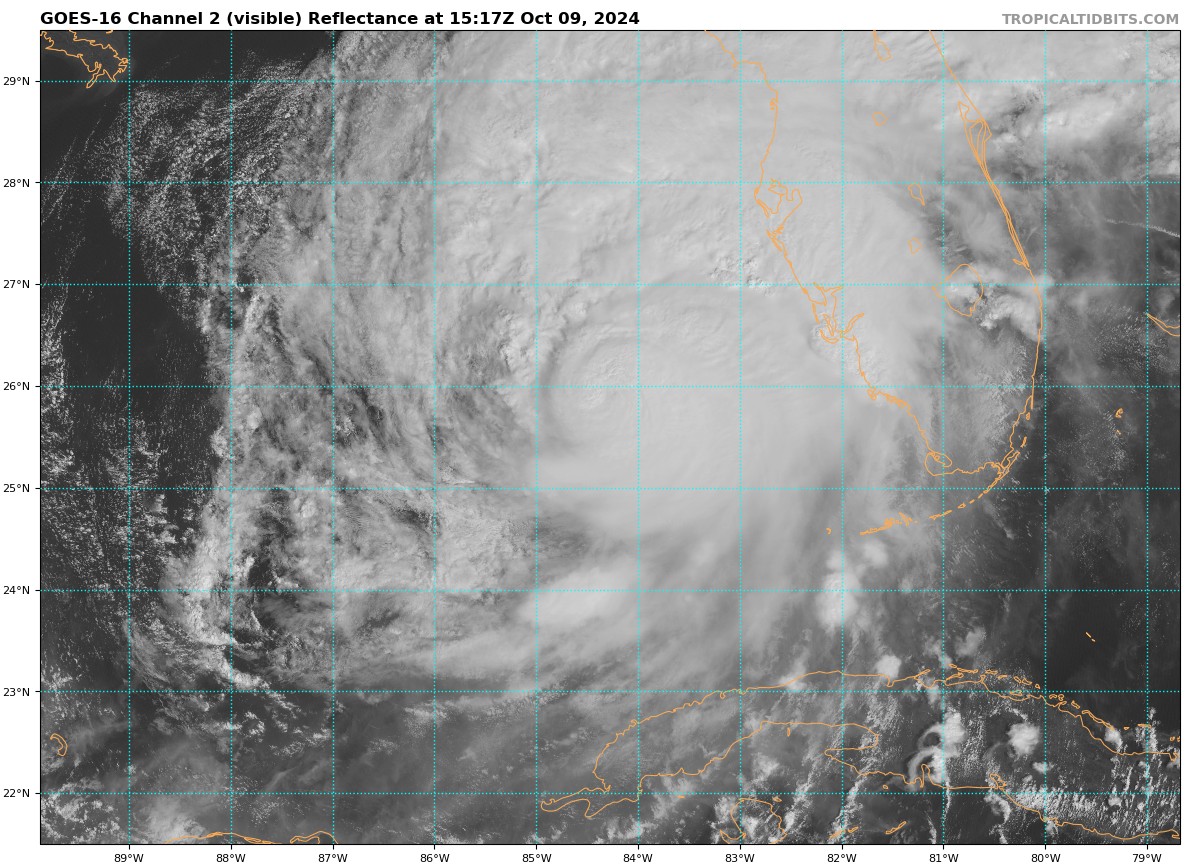
It has gotten very hectic over the past hour or so. For those who don’t know, I am the owner of Tornado Talk and we write and research tornado history. We may be writing on today’s event! We have had some Kansas looking tornadoes form across parts of Florida and it has been eye-popping and scary to see. These are certainly not your typical fast-moving, hard to see twisters. They are large and very visible.
10:10 am 10/9 – Confirmed tornado in Broward County after crossing I-75 in Palm Beach County. This is associated with Hurricane #Milton. We will see a tornado threat developing this afternoon. pic.twitter.com/1ehalIrkOn
— Brooks Garner (@BrooksWeather) October 9, 2024
Let’s get to the latest NHC update:
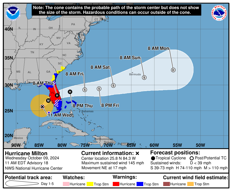
SUMMARY OF 1100 AM EDT…1500 UTC…INFORMATION
———————————————–
LOCATION…25.8N 84.3W
ABOUT 160 MI…255 KM WSW OF FT. MYERS FLORIDA
ABOUT 190 MI…305 KM SW OF TAMPA FLORIDA
MAXIMUM SUSTAINED WINDS…145 MPH…230 KM/H
PRESENT MOVEMENT…NE OR 35 DEGREES AT 17 MPH…28 KM/H
MINIMUM CENTRAL PRESSURE…931 MB…27.50 INCHES
No changes with advisories with this update
We have definitely seen a change in the structure of Milton since it has been encountering the forecasted shear. The eye has filled with clouds and there is some drier air intruding the system on the west side. Hurricane Hunters have the pressure at 931mb which is well up from the 919 mb report at 10am Eastern Time.
Milton will be over water for about 12 more hours or so. It will continue to run into shear but tremendous weakening is not expected to occur at the center. As has been the thought for a couple of days, it will be a major hurricane at landfall. The winds at the center may lower but the overall windfield is getting bigger. And the surge impacts are still very high. A growing system in size, which was once a Cat 5 is barrelling into the West-Central Florida Coast. All that water is coming in. Where the highest surge will be is very difficult to pinpoint. This paragraph from the NHC is extremely important from the latest advisory:
We would like to emphasize that Milton’s exact landfall location is not possible to predict even at this time, particularly if the hurricane wobbles during the day and into this evening. Even at 12-24 hours, NHC’s track forecasts can be off by an average of 20-30 nm. Since storm surge forecasts are highly sensitive to the exact track, this means that the realized storm surge heights across the Tampa Bay region and south may vary widely, and there will likely be a noticeable gradient of surge heights to the north of the landfall location. However, the risk of devastating storm surge still exists
across much of the west-central and southwest coast of Florida given the size of the storm and the uncertainties in exactly where landfall will occur.
The highest surge will be near and south of where the center crosses inland. That could be in the 10-15 foot range. Here is the latest surge map:
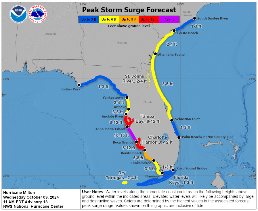
A widespread area of storm surge of 10 feet or greater is possible for a large area of west-central Florida. Tremendous rain and flooding is likely. An enhanced risk of tornadoes for the Central and Southern parts of the state in place. Widespread winds with an expanding storm will cause damage and power outages. This is it folks, the next 24 hours are going to be very long for our friends in Florida. We are thinking about them and will do our best to pass on important real-time information through the duration of the event.
Category: ALL POSTS, Social Media, Tropical
About the Author (Author Profile)
Owner of Tornado Talk. Radio broadcast meteorologist with The Storm Report. WeatherBrains Panelist. B.S. Meteorology from Penn State University.Subscribe
If you enjoyed this article, subscribe to receive more just like it.


