
Dry Through The Weekend; Milton Stays Far To The South
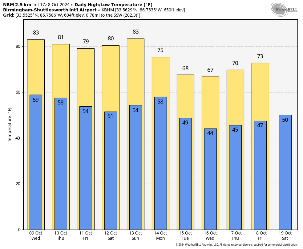
SUNNY, PLEASANT DAY: The sky is sunny across Alabama, with temperatures in the 70s over the northern half of the state, and in the 80s across the southern counties. Tonight will be clear and cool with a low in the 50s and 60s.
DRY THROUGH THE WEEKEND: It is a dry forecast for the Deep South through the weekend with sunny pleasant days and clear cool nights. Highs will be mostly in the upper 70s and low 80s, with lows in the 50s over the northern and central counties… 60s to the south.
Even cooler air arrives next week; highs drop into the 60s with lows in the 40s over the northern 2/3 of the state by Tuesday and Wednesday (October 15-16). And, still no sign of any meaningful rain for Alabama for at least the next 7-10 days. See the video briefing for maps, graphics, and more details.
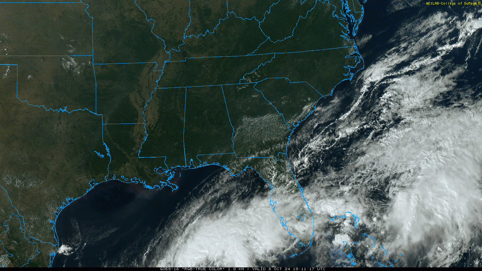
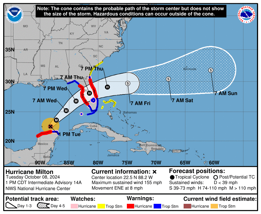
TROPICS: Hurricane Milton remains a category four hurricane with sustained winds of 155 mph. It is about 520 miles southwest of Tampa, moving to the east/northeast at 8 mph. Landfall is forecast late tomorrow night/early Thursday morning at Tampa Bay; NHC expects Milton to be a category three hurricane then with winds of 125 mph.
While the winds are expected to be a bit lower, the size of the hurricane will be much larger tomorrow night, and a destructive storm surge of 10-15′ is expected along and south of the landfall point. This is a dangerous, life-threatening situation for the West Coast of Florida, and damage is likely inland as well for places like Orlando where hurricane force winds are likely. Some will be without power for days, and possibly weeks in some cases.
Elsewhere, Leslie is a weakening tropical storm in the middle of the Atlantic that will stay far from land. And, A non-tropical area of low pressure located just northeast of the northwestern Bahamas is producing gale-force winds. This system could acquire some tropical or subtropical characteristics over the next day or so while the low moves northeastward to east-northeastward around 15 mph. Upper-level winds are likely to increase by tomorrow night, which should end any chances for further development. NHC gives it only a 20 percent chance of development.
ON THIS DATE IN 1946: A minimal Category 1 hurricane made landfall over Bradenton, Florida, before tracking north-northeast across Tampa Bay. The storm was the last hurricane to make direct landfall in the Tampa Bay area.
Look for the next video briefing here by 6:00 a.m. tomorrow…
Category: Alabama's Weather, ALL POSTS, Weather Xtreme Videos
About the Author (Author Profile)
James Spann is one of the most recognized and trusted television meteorologists in the industry. He holds the AMS CCM designation and television seals from the AMS and NWA. He is a past winner of the Broadcast Meteorologist of the Year from both professional organizations.Subscribe
If you enjoyed this article, subscribe to receive more just like it.


