
1PM CDT Milton Update: Hurricane Hunters Have Found that Milton Has Resumed Intensifying
The NHC notes in its latest update that Milton has resumed strengthening. There are only a few hours remaining for residents to complete their preparations. Winds are at 155 mph, and the pressure is now at 923 mb.
Here are the latest stats:
SUMMARY OF 100 PM CDT…1800 UTC…INFORMATION
———————————————-
LOCATION…22.5N 88.2W
ABOUT 125 MI…205 KM NE OF PROGRESO MEXICO
ABOUT 520 MI…840 KM SW OF TAMPA FLORIDA
MAXIMUM SUSTAINED WINDS…155 MPH…250 KM/H
PRESENT MOVEMENT…ENE OR 65 DEGREES AT 8 MPH…13 KM/H
MINIMUM CENTRAL PRESSURE…923 MB…27.26 INCHES
SUMMARY OF WATCHES AND WARNINGS IN EFFECT:
A Storm Surge Warning is in effect for…
* West coast of Florida from Flamingo northward to the Suwannee
River, including Charlotte Harbor and Tampa Bay
* East coast of Florida from Port Canaveral northward to the mouth
of the St. Mary’s River, including the St. Johns River.
A Hurricane Warning is in effect for…
* Celestun to Rio Lagartos
* Florida west coast from Bonita Beach northward to the mouth of the
Suwannee River, including Tampa Bay
* Florida east coast from the Indian River/St. Lucie County Line
northward to Ponte Vedra Beach
A Storm Surge Watch is in effect for…
* South of Port Canaveral to Sebastian Inlet
* Mouth of the St. Mary’s River to Edisto Beach
A Hurricane Watch is in effect for…
* Rio Lagartos to Cabo Catoche
* Dry Tortugas
* Lake Okeechobee
* Florida west coast from Chokoloskee to south of Bonita Beach
* Florida east coast north of Ponte Vedra Beach to the mouth of the
St. Mary’s River
A Tropical Storm Warning is in effect for…
* Rio Lagartos to Cancun
* All of the Florida Keys, including Dry Tortugas and Florida Bay
* Lake Okeechobee
* Florida west coast from Flamingo to south of Bonita Beach
* Florida west coast from north of the mouth of the Suwanee River to
Indian Pass
* Florida east coast south of the Indian River/St. Lucie County
Line to Flamingo
* Florida east coast north of Ponte Vedra Beach to the mouth of the
St. Mary’s River
A Tropical Storm Watch is in effect for…
* Coast of Georgia and South Carolina from north of the mouth of the
St. Marys River to South Santee River, South Carolina
* Extreme northwestern Bahamas, including Grand Bahama Island,
the Abacos, and Bimini.
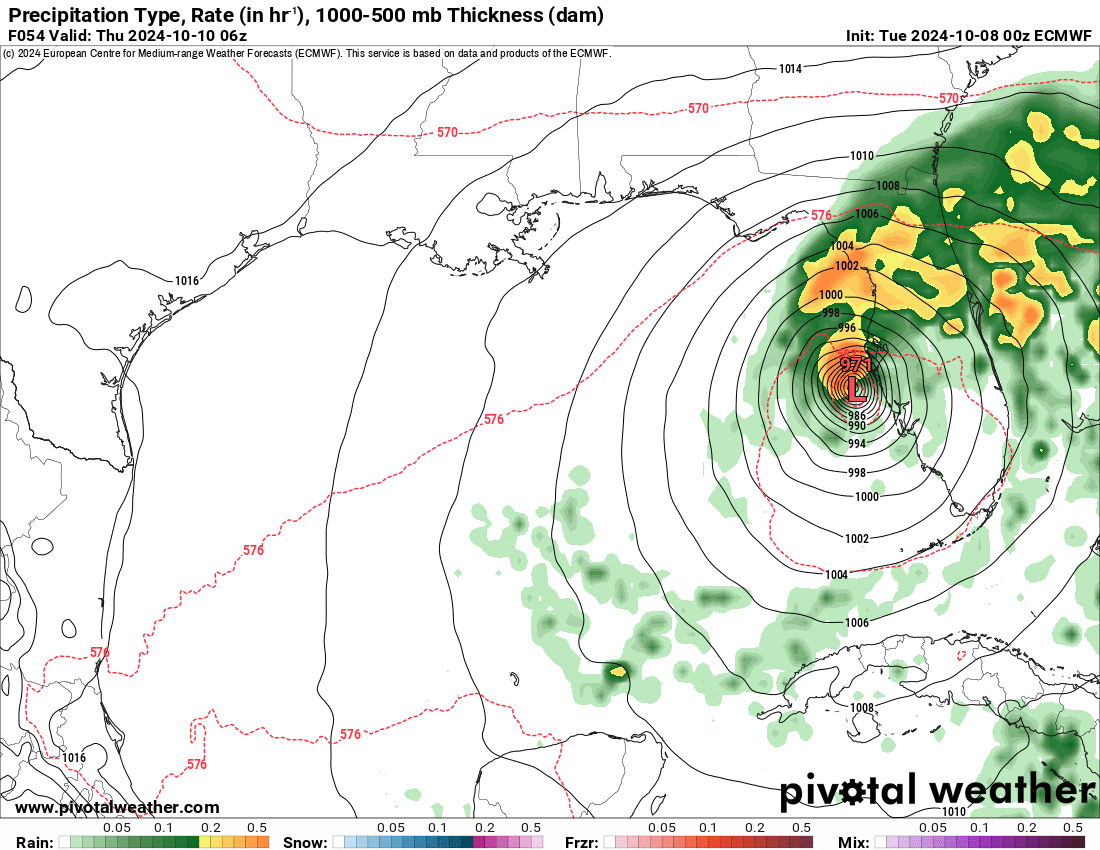
Milton is expected to make landfall in the overnight hours on Wednesday, and will travel across Florida during the day on Thursday. Milton will remain a major category through landfall. This is a life-threatening situation, and all people in Central Florida should take this very seriously.

The forecasted impacts remain the same at from the 10am CDT NHC update. Dangerous levels of storm surge, winds, rainfall, and flash flooding will occur along the western coast of Florida as well as across Central Florida. Isolated tornados are possible as well.
The EURO model shows Milton making landfall just south of the Tampa area overnight on Wednesday.
Category: ALL POSTS, Social Media, Tropical
About the Author (Author Profile)
Scott is a senior at Mississippi State University studying professional and broadcast meteorology.Subscribe
If you enjoyed this article, subscribe to receive more just like it.


