The Latest On Hurricane Milton from the 7am CDT Advisory: New Watches and Warnings for the East Coast of Florida
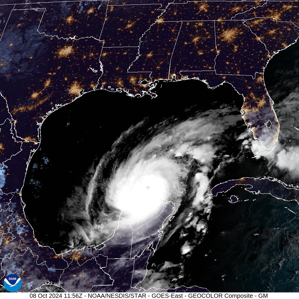
Milton is steadily moving ENE at 12 mph and is centered about 545 miles SW of Tampa, FL. Max winds are now at 145 mph with a pressure of 929mb. New Advisories issued for parts of the Florida East Coast.
Full stats
LOCATION…22.5N 88.8W
ABOUT 100 MI…165 KM NE OF PROGRESO MEXICO
ABOUT 545 MI…880 KM SW OF TAMPA FLORIDA
MAXIMUM SUSTAINED WINDS…145 MPH…230 KM/H
PRESENT MOVEMENT…ENE OR 75 DEGREES AT 12 MPH…19 KM/H
MINIMUM CENTRAL PRESSURE…929 MB…27.43 INCHES
Watches and Warnings
CHANGES WITH THIS ADVISORY:
A Storm Surge Warning has been issued from the Volusia/Brevard
County Line northward to the mouth of the St. Mary’s River,
including the St. Johns River.
A Hurricane Warning has been issued for the east coast of Florida
from the Indian River/St. Lucie County Line northward to Ponte
Vedra Beach.
A Tropical Storm Warning has been issued for the southeast coast of
Florida south of the Indian River/St. Lucie County Line to
Flamingo, and for the northeast coast of Florida north of Ponte
Vedra Beach to the mouth of the St. Mary’s River.
The government of Mexico has discontinued all watches and warnings
south of Celestun.
The big update here is to upgrade to storm surge, hurricane and tropical storm warnings across portion of the Florida east coast. The main focus has been on the west coast of Florida as they will receive some of the worst surge and other impacts BUT based on the track, once Milton moves in and further east, the flow around it will push surge into the Atlantic side of Florida, hence the new warnings. This will be a dangerous go of it for areas like Daytona Beach up to St. Augustine and east of Jacksonville.
Current surge forecast:
Anclote River, FL to Englewood, FL…10-15 ft
Tampa Bay…10-15 ft
Englewood, FL to Bonita Beach, FL…6-10 ft
Charlotte Harbor…6-10 ft
Yankeetown, FL to Anclote River, FL…5-10 ft
Bonita Beach, FL to Chokoloskee, FL…4-7 ft
Suwannee River, FL to Yankeetown, FL…3-5 ft
Chokoloskee, FL to Flamingo, FL…3-5 ft
Volusia/Brevard County Line, FL to Altamaha Sound, GA…3-5 ft
Winds have come down a bit at the center but still a dangerous Category 4 storm. The forecast does call for it to possibly strengthen again and the windfield will expand.
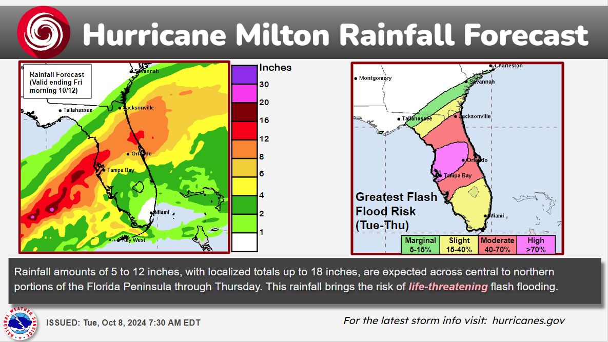
Wanted to share this graphic from the WPC with the rainfall forecast and the risk of life-threatening flash flooding.
We will have more details with the 10am advisory including some updates from the hurricane hunters!
Category: ALL POSTS, Social Media, Tropical
About the Author (Author Profile)
Owner of Tornado Talk. Radio broadcast meteorologist with The Storm Report. WeatherBrains Panelist. B.S. Meteorology from Penn State University.Subscribe
If you enjoyed this article, subscribe to receive more just like it.


