Dry Days Ahead For Alabama; Trending Cooler
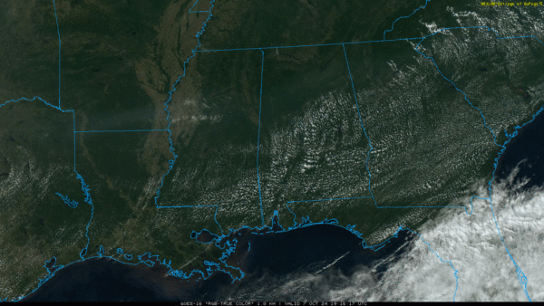
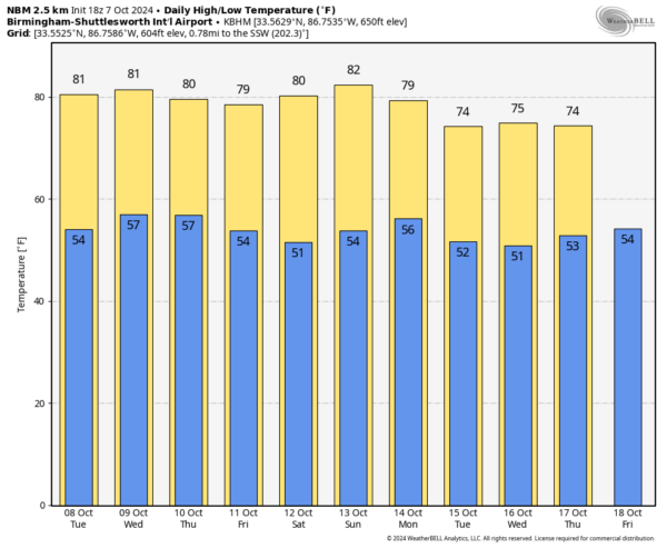
DRY DAYS: A dry cold front is passing through Alabama this afternoon; the sky is mostly sunny with temperatures in the 80s. The weather turns cooler tonight; most communities dip into the 50s early tomorrow morning thanks to the airmass change.
We expect sunny days and fair cool nights through the weekend. Highs will be in the upper 70s and low 80s, with lows in the 50s. Some of the colder pockets across North Alabama could reach the 40s early Friday morning.
And, dry weather continues next week with highs in the 70s and lows mostly in the 50s. See the video briefing for maps, graphics, and more details.
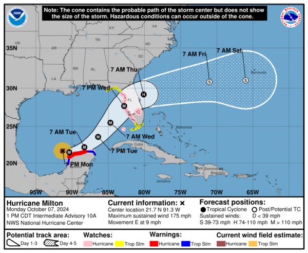
TROPICS: Hurricane Milton this afternoon is about 700 miles southwest of Tampa with winds of 175 mph; it exploded in intensity today. It is moving to the east at 9 mph. Landfall is expected near Tampa Bay Wednesday night… Milton will be weakening by then, but is still expected to be a major hurricane with a large wind field and destructive storm surge. A Hurricane Watch remains in effect for the Gulf coast of Florida from Chokoloskee northward to the mouth of the Suwanee River, including Tampa Bay, and the Dry Tortugas.
Milton will not impact the central Gulf Coast (Gulf Shores to Panama City Beach) in any way other than a high rip current danger.
Elsewhere, Hurricane Kirk is becoming post-tropical over the North Atlantic, and Hurricane Leslie in the central Atlantic will turn northward and slowly weaken; no threat to land. A new wave coming off the African coast has a 30 percent chance of development, but if anything forms it will also most likely turn north far from land.
ON THIS DATE IN 2016: Hurricane Matthew was off the northeast coast of Florida. Matthew brought intense rainfall to the Carolinas on the 8th and 9th.
Look for the next video briefing here by 6:00 a.m. tomorrow…
Category: Alabama's Weather, ALL POSTS, Weather Xtreme Videos


