4am CDT Tropics Update: Hurricane Hunters Heading Toward TS Milton; Quick Intensification is Forecast
Milton is forecast to become a major hurricane as it approaches the west coast of Florida. There will be widespread impacts and hurricane plans should be enacted. Life-threatening surge, major wind impacts and flooding to occur.
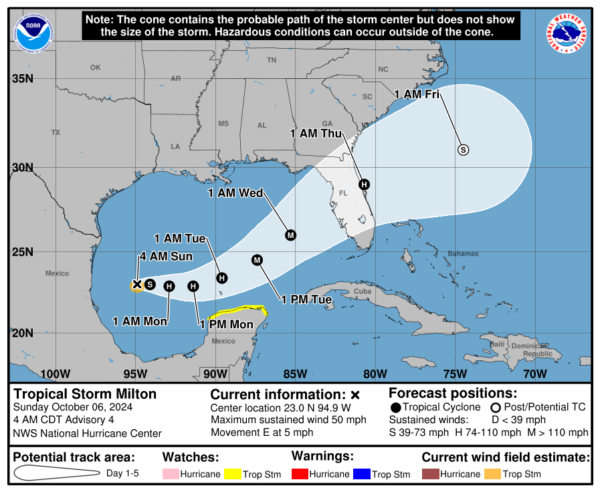
Here is a look at the 4am CDT advisory information from the NHC:
Stats:
LOCATION…23.0N 94.9W
ABOUT 355 MI…565 KM WNW OF PROGRESO MEXICO
ABOUT 845 MI…1360 KM WSW OF TAMPA FLORIDA
MAXIMUM SUSTAINED WINDS…50 MPH…85 KM/H
PRESENT MOVEMENT…E OR 90 DEGREES AT 5 MPH…7 KM/H
MINIMUM CENTRAL PRESSURE…1003 MB…29.62 INCHES
Advisories:
Nothing new at this time but hurricane and storm surge watches will be hoisted for portions of Florida as the day goes on.
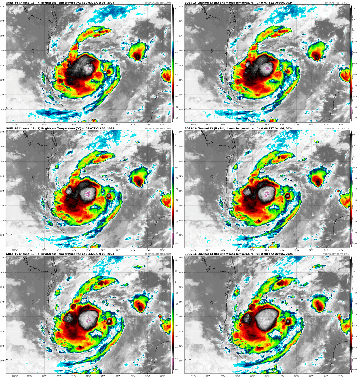
You can see by the satellite that Milton is getting organized with some convection flares. We will start getting more information now that we have the hurricane hunters flying into the storm. Key takeaways from the detailed NHC discussion:
The strengthening forecast is complex. The guidance is showing several solutions for how strong Milton could get as it approaches the west coast of Florida. From the discussion, “The intensity guidance continues to show a significant spread in the forecast peak intensity in 60-72 h, with possibilities ranging from category 1 to category 5 strength.” There are several things to be watched as Milton moves east to see how it takes some of the environmental factors it may run into. The Gulf waters are plenty warm so that will not be a hindrance and over the next 60 hours, Milton will be in a favorable area for strengthening, possibly rapid intensification. As it approaches the west coast of Florida, it could encounter drier air and stronger shear which could have an impact. Models are not consistent on how much weakening could occur. And right now, it does not appear to be enough weakening.
Milton is moving east. A trough is expected to influence the system, causing it to move northeast and it will pick up pace. The models differ on exactly where Milton will cross Florida. “It should be noted that the average NHC track error at day 4 is around 150 miles.
Therefore, users are reminded to not focus on the exact track.”
Milton is expected to be a major hurricane off the coast of Florida in 72 hours. The wind forecast at the center at that time is 120 mph. Whether or not Milton maintains that intensity at landfall is still uncertain BUT it will be a hurricane (possibly major) at the time of landfall. Hurricanes are not a point on a map. Yes, where the center makes landfall is important but there will be widespread impacts for Florida. Due to the angle it is coming in, the storm surge concerns are high for many areas. That push of water from a strengthening hurricane will come right into the west coast of Florida and it could be devastating.
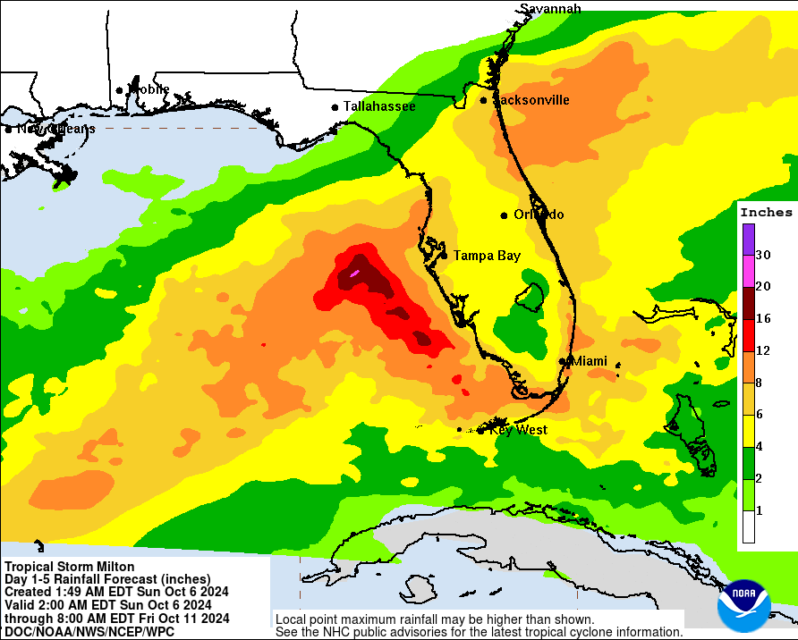
Heavy rain is setting up due to moisture interacting with a front so WELL ahead of Milton coming in. Then more heavy rain will come in with the storm. This brings in huge concerns for flooding for portions of Florida. Here is the current rainfall forecast:
Our friends across the west coast of Florida need to be prepping for a major hurricane to arrive by mid week. Life-threatening surge, destructive winds and major flooding expected.
Category: ALL POSTS, Social Media, Tropical


